Region
Tokyo Live Cameras in Japan — 19 official webcams
Five street-level live streams, six cameras on the volcanoes of the Izu Islands and eight on the lower Arakawa. Crossings in Shinjuku and Shibuya, and volcanic islands more than 100 km south of the city.
What you can see
The nineteen fall into three groups. Five are street-level live video, six are Japan Meteorological Agency cameras on the volcanic Izu Islands, and eight are Ministry of Land, Infrastructure, Transport and Tourism cameras on the Arakawa.
The five street cameras are streamed by the owners of the buildings they sit on, or by broadcasters, under their own names. Shinjuku Station East looks down on the plaza from the position of the large screen known for its 3D cat, and plays inside this page. Shibuya Scramble Crossing and the Rainbow Bridge come from a broadcaster, and Senso-ji is two cameras run by the temple itself, one facing the main hall and one facing the Kaminarimon gate.
The islands, north to south: Izu-Oshima, Niijima, Kozushima, Miyakejima, Hachijojima and Aogashima. All have eruption records, and on Izu-Oshima (1986) and Miyakejima (2000) the whole population was evacuated off the island.
The eight Arakawa cameras run downstream in order, from the Iwabuchi Floodgate in Kita ward at 20.5 km to Shinsuna at -0.5 km. Because every one carries a kilometre marker, adding the two Saitama cameras upstream lets you step from 28.8 km down to the mouth.
19 cameras in Tokyo
5 video, 14 still. Tap one to open it in the camera list.
-
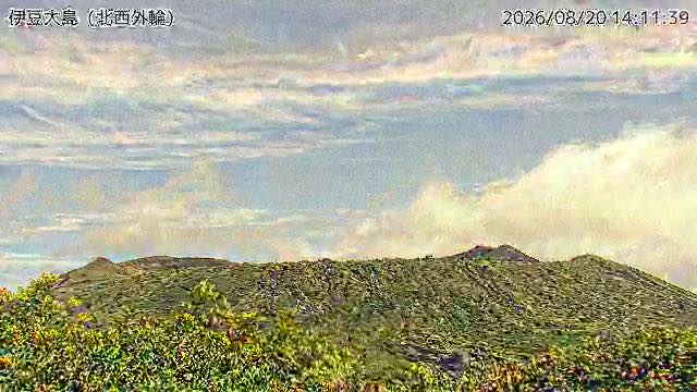 Sample August 2026
Izu Oshima
Oshima, Tokyo · Volcano · Sea
The 1986 eruption evacuated every resident off the island. The camera looks at the Mount Mihara caldera from the northwest rim.
-
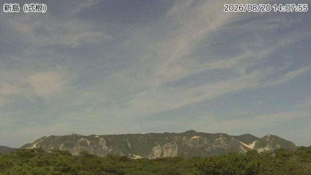 Sample August 2026
Niijima
Niijima, Tokyo · Volcano · Sea
An island of white rhyolite, long quarried for building stone. The camera faces neighbouring Shikinejima.
-
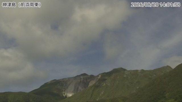 Sample August 2026
Kozushima
Kozushima, Tokyo · Volcano · Sea
An island where the record shows Mount Tenjo was formed in an eruption in 838. The view from Maehama beach takes in the pale rock face and the harbour.
-
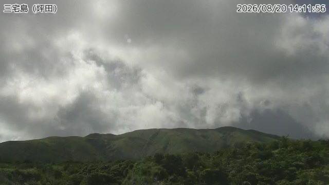 Sample August 2026
Miyakejima
Miyake, Tokyo · Volcano · Sea
Volcanic gas kept coming after the 2000 eruption, and islanders lived off the island for more than four years. The camera is on the southeast side.
-
 Sample August 2026
Hachijojima
Hachijo, Tokyo · Volcano · Sea
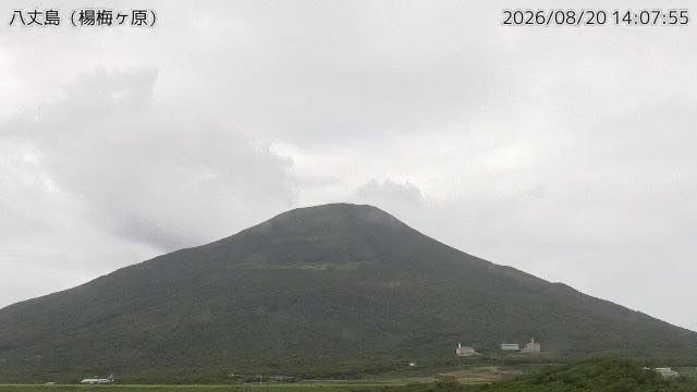
An island made where two volcanoes, Hachijo-Fuji and Mount Mihara, joined. From the high ground the camera sits on, slope and sea run on together.
-
 Sample August 2026
Aogashima
Aogashima, Tokyo · Volcano · Sea
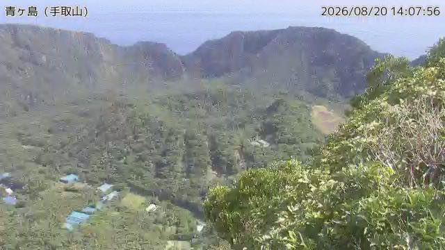
A double caldera with another hill rising inside the first. It has the smallest population of any inhabited island in Japan.
-
 Sample August 2026
Iwabuchi Floodgate
Kita, Tokyo · River
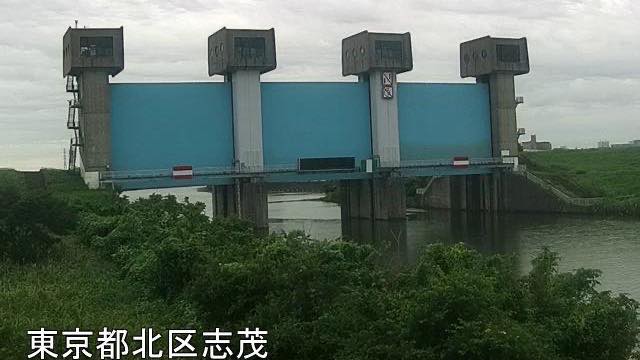
The floodgate where the Sumida River branches off the Arakawa, seen from Kita ward on the right bank. The picture refreshes every minute. The blue gates stand across the middle of the frame. 20.5 km from the mouth.
-
 Sample August 2026
Goshikizakura Bridge
Adachi, Tokyo · River
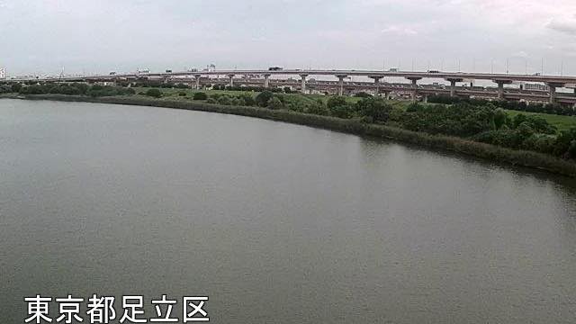
17.1 km from the mouth. A double-deck bridge carrying the Kawaguchi expressway over the river; at night the pier lighting stretches across the water.
-
 Sample August 2026
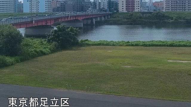
Above Nishiarai Bridge
Adachi, Tokyo · River
13.8 km from the mouth, looking upstream of Nishiarai Bridge from the left bank. Tower blocks line the far side and the water picks up their lights.
-
 Sample August 2026
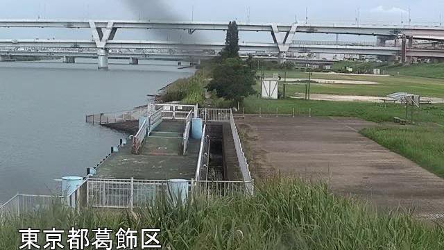
Horikiri emergency wharf
Katsushika, Tokyo · River
9.8 km from the mouth of the Arakawa. From the Katsushika bank the whole width of the river and the bridges upstream fit in the frame. It is a landing for boats in a disaster, and how far the water has risen shows on the steps in the foreground.
-
 Sample August 2026
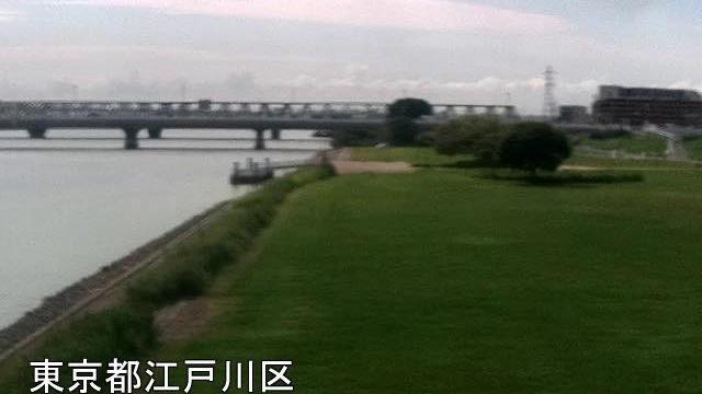
Above Hirai Bridge
Edogawa, Tokyo · River
6.4 km from the mouth, looking upstream of Hirai Bridge from the right-bank levee. The low viewpoint puts the full width of the river on screen.
-
 Sample August 2026
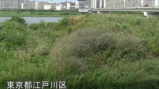
Below Metropolitan Expressway Route 7
Edogawa, Tokyo · River
4.3 km from the mouth, downstream of where Route 7 crosses. The near bank is high floodplain thick with reeds.
-
 Sample August 2026
Komatsugawa emergency wharf
Edogawa, Tokyo · River
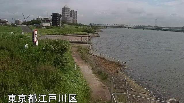
2.4 km from the mouth. Central Tokyo's towers stand beyond the far bank, and on a clear day their outlines are sharp.
-
 Sample August 2026
Shinsuna emergency wharf
Koto, Tokyo · River
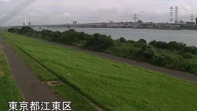
The marker here reads -0.5 km, the closest the Arakawa gets to the sea. This stretch is tidal, and the level rises and falls within the day.
-
Live video
Shinjuku Station East
Shinjuku, Tokyo · City
The plaza and crossings outside the east exit, seen from the position of the big screen known for its 3D cat. The street of electronics shops and the railway beyond it fit in the same frame.
-
Live video
Shibuya Scramble Crossing
Shibuya, Tokyo · City
The crossing that people pour into from five directions, seen from above at an angle. Each change of the lights fills the crossing and empties it again. At night the advertising on the surrounding buildings lights the whole scene.
-
Live video
Rainbow Bridge
Minato, Tokyo · City · Sea
The bridge across Tokyo Bay, seen from the Odaiba side. The towers of the city stack up beyond it, and at sunset the sea and the sky take the same colour.
-
Live video
Senso-ji, towards the main hall
Taito, Tokyo · World Heritage · City
The grounds seen from under the eaves. The Hozomon gate stands ahead, and directly below the camera people climb and descend the stone steps of the hall in front.
-
Live video
Senso-ji, towards Kaminarimon
Taito, Tokyo · World Heritage · City
The same height, turned the other way. Nakamise street runs off in a straight line, and the band of people heading for the Kaminarimon gate can be followed right to the end. The rows of roofs on either side mark the way.
When to watch
The island cameras are the volcanoes that belong to Tokyo, listed north to south: Oshima, Niijima, Kozushima, Miyakejima, Hachijojima and Aogashima. Every one is surrounded by sea, so there is a horizon somewhere in each frame. Aogashima has the unusual shape of a caldera inside a caldera, and is also the least populated municipality in Japan.
Island cameras live at the mercy of the weather. Fog and cloud build fast over the sea, and from the rainy season through summer the screen can stay white for days. The dry air of a winter pressure pattern gives the longest views.
The Arakawa cameras come from the ministry's Arakawa-Karyu River Office: the Iwabuchi Floodgate (Kita), Goshikizakura Bridge and Nishiarai Bridge (Adachi), Horikiri (Katsushika), Hirai Bridge, the Metropolitan Expressway Route 7 crossing and Komatsugawa (Edogawa), and Shinsuna (Koto) - arranged from upstream down to the mouth. Everything below that floodgate is a man-made channel, dug between the end of the Meiji era and the early Showa era to carry floods out to sea, which is why it runs so straight and wide between high levees.
Each image is stamped with the river name and the distance marker, in kilometres from the mouth. Horikiri, Komatsugawa and Shinsuna are emergency wharves, built to move people and supplies by boat during a disaster.
River cameras earn their keep in heavy rain and typhoons. Normally the water is low and the floodplain shows a wide expanse of playing fields and grass; as the river rises that goes under in sequence, so watching from Sasameba upstream to Shinsuna at the mouth shows the water arriving. On a clear day the minute-by-minute stills change little beyond a few walkers on the bank and traffic crossing the bridges.
The street cameras work the other way round: the hour is everything. At Shibuya and Shinjuku the crossings fill and empty with each change of the lights, busiest from early evening into the night and close to empty by the small hours. Senso-ji opens its main hall at 06:00 (06:30 from October to March), so before the Nakamise shops open the stone paving is bare. The Rainbow Bridge has its best colour around sunset.
Closer looks at cameras here
- Izu Oshima1
- Iwabuchi Floodgate1
- The Arakawa in Adachi2
- Horikiri1
- The Arakawa in Edogawa3
- The Arakawa in Koto1
- The Arakawa10
- Kozushima1
- Hachijojima1
- Aogashima1
- Niijima1
- The Izu Islands7
- JMA Volcano Watch Cameras49
- Temple and Shrine Approaches23
- Shibuya Crossing & Station Fronts12
- Tides9
- Bridges20
- Sunrise and Sunset13
Agencies publishing the cameras on this page
- Cross Shinjuku Vision (Links free, no reuse) — Official site
- FNN Prime Online (Links free, no reuse) — Official site
- Japan Meteorological Agency — volcano surveillance cameras (PDL 1.0) — Official site
- MLIT Arakawa Downstream River Office (PDL 1.0) — Official site
- Senso-ji Temple (Links free, no reuse) — Official site
The footage belongs to each agency. This site is an unofficial guide, and each sample frame was copied once per camera under that agency's terms of use.