Volcano
Sakurajima: 2 Live Cameras in Japan
One of the most active volcanoes in Japan, venting ash on an ordinary day. Two agencies watch it from different angles, and there is usually something in shot.
What you can see
Sakurajima is a volcano in Kagoshima Bay. Lava from the great Taisho eruption of 1914 joined it to the Osumi Peninsula, and it has been a peninsula rather than an island ever since. The summit crater of Minamidake and the Showa crater still vent, which makes this one of the few cameras where someone who came to check whether it is erupting will usually find something.
There are two. The Meteorological Agency camera is a monitoring camera refreshing every two minutes, close enough to continuous that you can watch a plume stretch out. The transport ministry camera is there to watch for debris flows, so its interest is in the valleys at the foot rather than the mountain.
To tell plume from cloud, look at the base. Rising from a single point at the summit means plume; lying at some height unrelated to the mountain means cloud. A grey cast means it is carrying ash.
Cameras you can watch now: 2
All 2 are still images. Tap one to open it in the camera list.
-
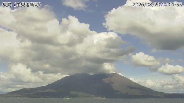 Sample August 2026
Sakurajima (JMA camera)
Kagoshima · Volcano
Across the water from central Kagoshima, one of the most frequently erupting volcanoes in Japan. A different angle on it than the ministry's cameras.
-
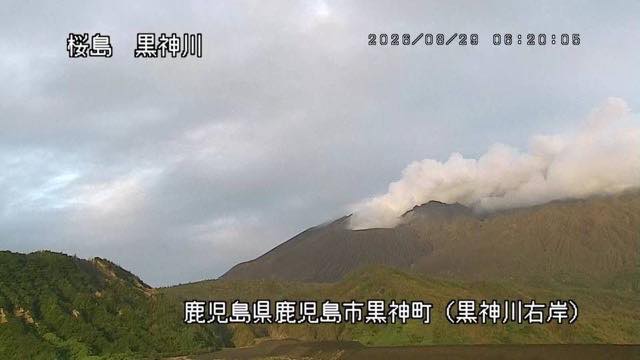 Sample August 2026
Sakurajima surveillance cameras
Kagoshima · Volcano
Cameras watching the plume, the ashfall and the debris flows. When the volcano is active you can see ash rising from the summit.
When to watch
Sakurajima barely changes with the season. When it is active it vents whatever the month, so time of day matters more. Just after sunrise and before sunset it is backlit, and the plume glows white with light coming through it.
Which way the plume goes is decided by the wind. Winter's northwesterlies push it towards the Osumi Peninsula, away from the city; summer's southerlies push it over Kagoshima itself, so the direction the smoke stretches in the frame changes with the season.
Nights are mostly pitch dark, but when activity picks up the crater can glow red. The monitoring cameras keep refreshing through the night, so it is worth opening one in the small hours.
If it isn't showing
Both cameras are stills, but they are aimed at different things. The Meteorological Agency's looks at the mountain itself; the transport ministry's is a debris-flow camera, so its interest lies in the valleys at the foot rather than the summit. To follow the shape of the plume, open the Meteorological Agency one.
The volcanic islands strung out to the south are gathered on The Satsunan Volcanic Islands. Other Kyushu volcanoes under the same watch are Mount Aso, The Kirishima range, Kuju and Tsurumi and Mount Unzen — when this one is under cloud, one of those is usually clear.
Everything in the prefecture is on the Kagoshima page, and the rivers crossing it on Rivers of Miyazaki and Kagoshima. Snow does settle on Sakurajima on occasion, so the Meteorological Agency camera is also listed under First Snowcap.
Where to find Sakurajima
Agencies publishing the cameras on this page
- Japan Meteorological Agency — volcano surveillance cameras (PDL 1.0) — Official site
- Ministry of Land, Infrastructure, Transport and Tourism (PDL 1.0) — Official site
The footage belongs to each agency. This site is an unofficial guide, and each sample frame was copied once per camera under that agency's terms of use.