Region
Nagano Live Cameras in Japan — 8 official webcams
Three volcanoes of the southern Northern Alps - Yakedake, Norikura and Ontake - two 4K live streams from Kamikochi, and Zenko-ji temple and Nagano station in the city. Monitoring eyes, visitors' eyes and street eyes on one prefecture.
What you can see
Three of the eight are volcanoes under constant watch by the Japan Meteorological Agency, one is a scenic camera from the Ministry of the Environment, two are live video coming out of Kamikochi, and two are street cameras in the city of Nagano. Two of them point at Mount Norikura for different reasons - the Environment Ministry's Norikura Kogen as a view up to the ridge from the plateau, the Meteorological Agency's as a monitoring shot of the same peaks.
Both Kamikochi cameras are video. Kappa-bashi shows the Hotaka range beyond the suspension bridge over the Azusa river; the bus terminal camera shows the same ridge through larch woods. Both are streamed by the people who look after the place, and both play inside this page.
Mount Yake stands just south of Kamikochi; its 1915 eruption dammed the Azusa river and created Taisho Pond. Mount Ontake erupted in 2014 with heavy loss of life among climbers, and that eruption is why Japan reviewed volcano monitoring nationwide. Many of the cameras on this site trace back, indirectly, to this mountain.
The two city cameras are streamed by the local cable station. Zenko-ji has two cameras on the great gate and alternates between them, one facing the main hall and one facing the shopping street of the approach. JR Nagano Station looks down into the concourse from a building opposite, with the town and the mountains stacked behind the platforms.
8 cameras in Nagano
4 video, 4 still. Tap one to open it in the camera list.
-
 Sample August 2026
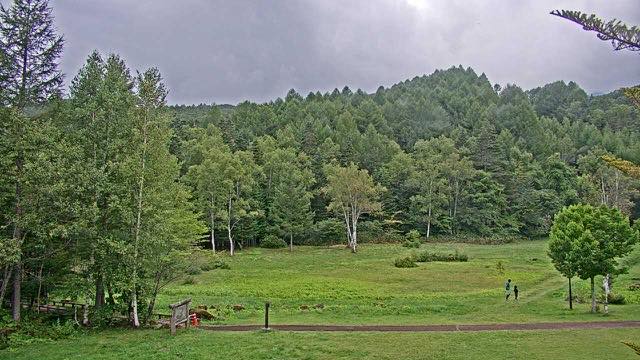
Mount Norikura from Norikura Plateau
Matsumoto, Nagano · Nature
A 3,000-metre ridgeline seen from the plateau below. Snow patches survive the summer, and on clear days you can pick out every notch in the ridge.
-
 Sample August 2026
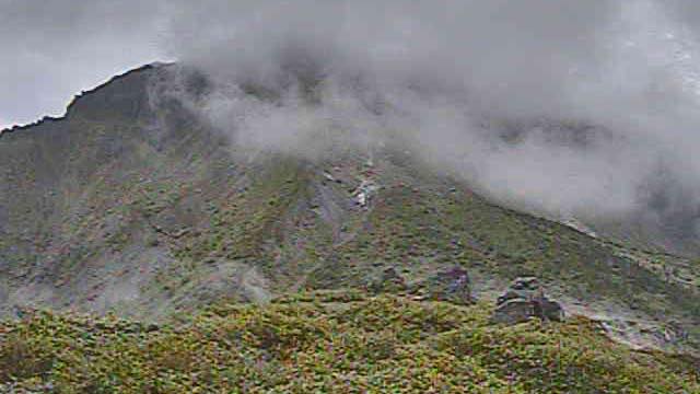
Mount Yake
Nagano / Gifu border · Volcano · Nature
Standing just south of Kamikochi. The 1915 eruption dammed the Azusa River and created Taisho Pond. Steam still rises near the summit.
-
 Sample August 2026
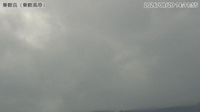
Mount Norikura
Nagano / Gifu border · Volcano · Nature
A bus takes you to nearly 2,700 metres. The camera looks at the summit ridge from the Norikura plateau side, where snow stays on the ridge for months.
-
 Sample August 2026
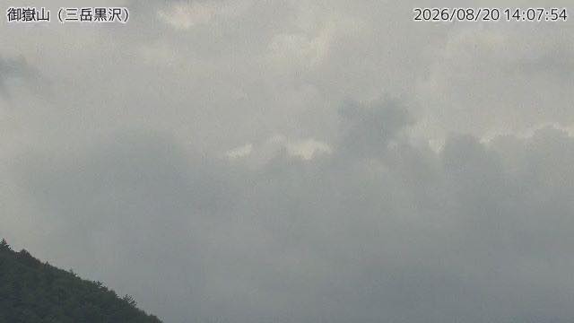
Mount Ontake
Nagano / Gifu border · Volcano
The 2014 eruption caused heavy casualties among climbers, and prompted a national review of how volcanoes are monitored.
-
Live video
Kappa-bashi, Kamikochi
Matsumoto, Nagano · Nature
The best-known view in Kamikochi: the Hotaka range standing beyond the suspension bridge over the Azusa river. The number of people on the bridge tells you how busy the valley is.
-
Live video
Kamikochi bus terminal
Matsumoto, Nagano · Nature
The Hotaka range through larch woods, seen from the gateway to Kamikochi. At 1,500 m with no town lights nearby, on a clear night the same frame fills with stars.
-
Live video
Zenko-ji temple
Nagano, Nagano · World Heritage
Two cameras on the great gate, alternating between a view of the main hall and a view down the shopping street of the approach. The operator says so in the stream description.
-
Live video
JR Nagano Station
Nagano, Nagano · City
The station area seen from a building in front of it. Track after track and the roofs of the platforms spread out, with the town and the mountains stacked behind.
When to watch
The Norikura Kogen camera looks up at Mount Norikura from around 1,500 m. Autumn colour runs from late September into mid-October, working its way down from the summit to the foot.
The higher the mountain, the more reliably cloud builds through the afternoon. For a clean ridgeline, open these early or through the morning. Mount Ontake has been watched more closely since the 2014 eruption, and the Meteorological Agency camera is part of that.
Kamikochi itself is open only from mid-April to mid-November (17 April to 15 November in 2026), and even then private cars cannot go in. The cameras open at any season and any hour, so you can have Kappa-bashi at dawn with nobody on it.
Zenko-ji holds a morning service at daybreak, and people gather on the approach before first light. In a Gokaicho year, held once every seven years, the grounds look nothing like their usual selves. The operator warns that the stream sometimes stops for technical reasons and comes back at a different address; if the button leads nowhere, look for it in the channel listing.
Closer looks at cameras here
- Mount Norikura2
- Mount Ontake1
- Kamikochi2
- JMA Volcano Watch Cameras49
- Autumn Leaves16
- Mount Yake and Niigata-Yakeyama2
- Temple and Shrine Approaches23
- Shibuya Crossing & Station Fronts12
- Bridges20
- Snow23
Agencies publishing the cameras on this page
- Gosenjaku Hotel Kamikochi (Links free, no reuse) — Official site
- INC Nagano Cable Television (Links free, no reuse) — Official site
- Japan Meteorological Agency — volcano surveillance cameras (PDL 1.0) — Official site
- Ministry of the Environment — Internet Nature Institute (PDL 1.0) — Official site
- Nature Parks Foundation (Links free, no reuse) — Official site
The footage belongs to each agency. This site is an unofficial guide, and each sample frame was copied once per camera under that agency's terms of use.