Region
Mie Live Cameras in Japan — 2 official webcams
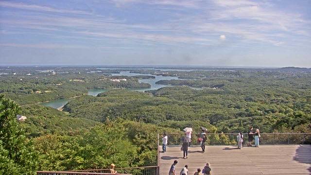
Ago Bay seen from Yokoyama, and river cameras on the Nabari and Uda. Ago Bay is a ria coastline strung with pearl-farming rafts — a landscape that only makes sense from above.
What you can see
One scenic camera from the Ministry of the Environment and one river camera from the Ministry of Land, Infrastructure, Transport and Tourism — sea and mountain, still image and video. Two cameras in the same prefecture could hardly look less alike.
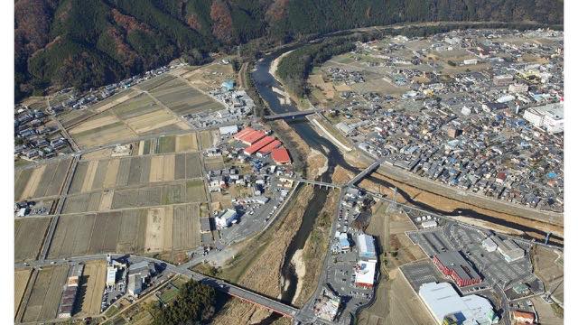
Ago Bay from Yokoyama looks down from high ground and takes in the whole ria coast at once, inlets and islands together. The thin lines on the water are pearl-farming rafts. The Nabari and Uda rivers gather the water of the Iga and Nabari basins on their way to the Kizu river; the valleys are deep, so a rise arrives quickly.
The inlets of Ago Bay are this intricate because the landform is a valley system that was once dry land and then drowned. The islands above the water are the high points of ridges from before the flooding; the inlets reaching far inland are the valleys themselves. The lines of pearl rafts have to do with that shape too: open-sea swell does not reach the inner bay, so the surface stays calm for long stretches. The landform and the industry are here for the same reason.
2 cameras in Mie
1 video, 1 still. Tap one to open it in the camera list.
-
 Sample August 2026
Ago Bay from Mount Yokoyama
Shima, Mie · Sea
A ria coast of countless islets and inlets seen from above. Thin lines of pearl oyster rafts run across the water.
-
 Stream cover
Nabari and Uda Rivers
Mie / Nara · River
Tributaries draining the Iga and Nabari basins into the Kizu. The valleys are deep, so a rise arrives fast.
When to watch
Ago Bay from Yokoyama is a viewpoint looking down over the whole tangle of inlets and islands. Late afternoon, when the sun drops and the water catches the light, is the best of it. Sunset is around 7 p.m. in summer and just before 5 p.m. in winter.
Sea cameras change colour completely between clear and cloudy days — enough that it can be hard to believe it is the same place. Worth opening on several days running.
Closer looks at cameras here
Agencies publishing the cameras on this page
- MLIT river live streams (Government Standard Terms 2.0) — Official site
- Ministry of the Environment — Internet Nature Institute (PDL 1.0) — Official site
The footage belongs to each agency. This site is an unofficial guide, and each sample frame was copied once per camera under that agency's terms of use.