River
The Rivers of Kumamoto and Nagasaki: 5 Live Cameras in Japan
Five live streams: four rivers in Kumamoto — including the Kuma, one of Japan's three swiftest — and the Hommyo through Isahaya in Nagasaki.
What you can see
The Kuma is one of the three fastest rivers in Japan. It drops hard through a narrow valley around Hitoyoshi, which means the level comes up very quickly after rain. The July 2020 downpour did severe damage along this basin.
The Shirakawa comes out of the Aso caldera and runs through central Kumamoto. Because the water carries volcanic ash, it clouds in a distinctive way when it rises — a different colour from ordinary brown silt, and once your eye knows it you can spot a rise at a glance.
The Kikuchi curves around the north of the Aso outer rim toward the Ariake Sea, through grain country farmed since antiquity, with paddy fields spread beyond the levees. The Midori runs south of the Kumamoto plain and has broad tidal flats at its mouth, where the channel visibly narrows at low water.
The Hommyo is a short river straight through the middle of Isahaya. In the 1957 Isahaya flood, that shortness and that route through a built-up town made the damage far worse. The monitoring here is unusually heavy for a river of its length, and that is why.
All five are rotating streams cycling through several points, so you may wait a little for the spot you want.
Cameras you can watch now: 5
All 5 are live video. Tap one to open it in the camera list.
-
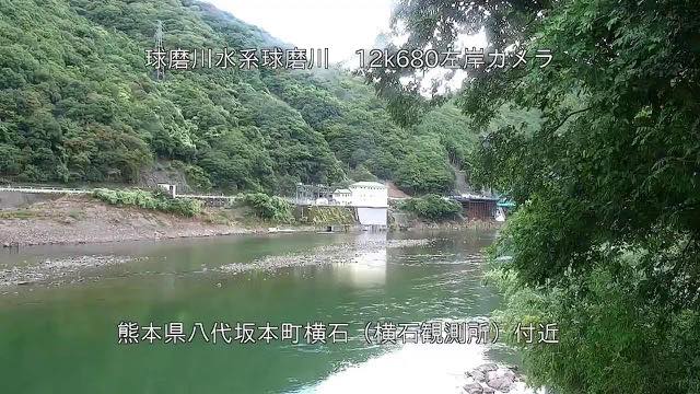 Sample August 2026
Kuma River
Hitoyoshi, Kumamoto · River
One of Japan's three fastest rivers. It drops hard through a narrow valley, so the level climbs quickly after rain.
-
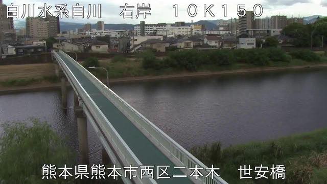 Sample August 2026
Shira River
Kumamoto · River
From the Aso caldera through central Kumamoto. Carrying volcanic ash, the water takes on a distinctive murk when it rises.
-
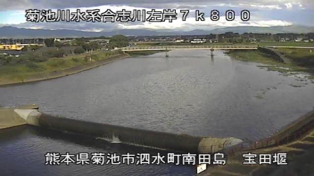 Sample August 2026
Kikuchi River
Tamana, Kumamoto · River
It rounds the north of the Aso caldera rim on its way to the Ariake Sea. The basin has been rice country since antiquity, with paddies beyond the levees.
-
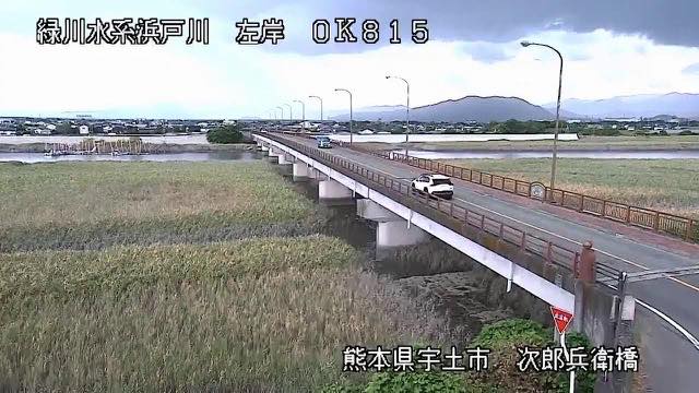 Sample August 2026
Midori River
Uto, Kumamoto · River
It runs south of the Kumamoto plain to the Ariake Sea. Broad tidal flats at the mouth make the river look visibly narrower at low tide.
-
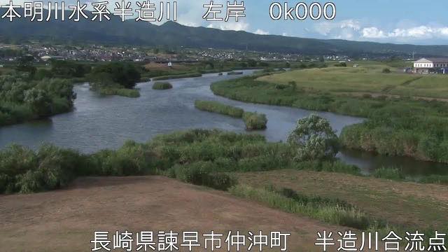 Sample August 2026
Honmyo River
Isahaya, Nagasaki · River
A short river through central Isahaya. Because of the 1957 flood disaster, it is watched especially closely.
When to watch
Late June and July, and typhoons. The Kuma and the Shirakawa both rise in mountains, so the level climbs even when no rain is falling in town. There is a lag while upstream rain works down — a calm-looking picture with the water quietly rising in it.
The worse the weather, the darker the image and the more the lens smears. Take evacuation decisions from your local authority, not from a camera.
On a calm day, two of these reward checking the tide times. The Kikuchi and the Midori both drain to the Ariake Sea, so width and water colour both change between low and high. Open them twice, six hours apart.
The Shirakawa's cloudiness lingers after the rain stops. Open it the day after rain over Aso and the city reach can be a different colour from everything else.
If it isn't showing
All five are rotating streams that cycle through several cameras along the river. You wait for the point you want, and the order is not yours to choose. At night it is dark, and rough weather smears the picture.
Four of the five are on the Kumamoto page and the Honmyo alone on Nagasaki. This is the only page that puts them side by side across the prefecture line.
Of the five, only the Kuma empties into the Yatsushiro Sea; the other four run to the Ariake Sea. The Shira comes out of the caldera on Mount Aso, so after heavy rain it carries a cloudiness of volcanic ash the others do not have. The other rivers of Kyushu are on The Rivers of Fukuoka and Saga, The Rivers of Oita and Rivers of Miyazaki and Kagoshima.
Where to find The Rivers of Kumamoto and Nagasaki
Agencies publishing the cameras on this page
- MLIT river live streams (Government Standard Terms 2.0) — Official site
The footage belongs to each agency. This site is an unofficial guide, and each sample frame was copied once per camera under that agency's terms of use.