Overseas
US national park live cameras
The National Park Service has 27 cameras here. Open them expecting a tourism feed and the angle can be a letdown — a lot of them point somewhere strikingly unremarkable. There is a reason for that. Most of them were not installed to show you the scenery. They were installed to look at the air.
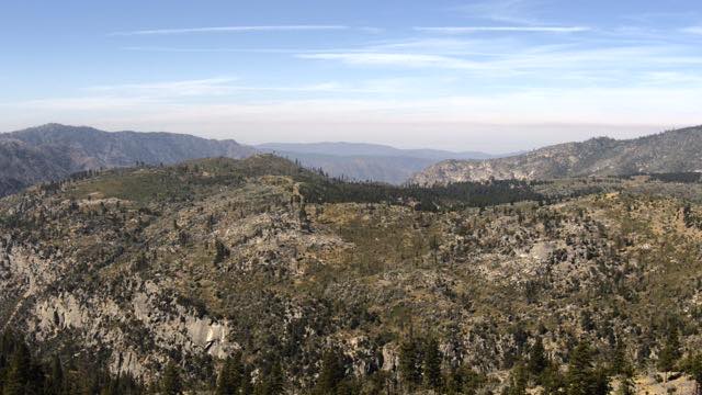
Those cameras are measuring how clear the air is
US national parks run air-quality monitoring, and part of it is a record of how sharply a distant ridge can be seen — visibility, in the technical sense. Keep that record going and you can track how the haze changes over years.
The instrument for that is a camera fixed on one direction, one view, shooting at fixed intervals. Line up years of identically framed photographs and a change reads at a glance: the ridge that was visible a decade ago is now lost in haze.
So the framing never moves. No zoom, no swinging around to the photogenic side. The purpose is nothing like a tourist's photograph, which means an angle that makes you wonder "why this direction?" is the normal case. Once you know that, a day when the far ridgeline stands out sharply becomes quietly satisfying.
Cameras on mountains
- Yosemite National Park (California) — a granite valley carved by glaciers. El Capitan and Half Dome stand in a row, and as the sun drops, hard shadows run across the rock. The face of it changes with the sun's angle, so it is worth comparing local morning against local evening.
- Mount Rainier National Park (Washington) — an enormous glaciated volcano, and famous for how rarely the summit is visible. More often than not it is inside cloud. A clear day with the whole mountain out is a win.
- Denali National Park (Alaska) — the park around North America's highest peak. The summit hides in cloud here too; locally, seeing the mountain counts as luck. Summer barely gets dark, and winter daylight is very short.
- Rocky Mountain National Park (Colorado) — a mountain park with a road over a pass above 3,000 m. Snow lingers on the ridges even at the height of summer, and thunderstorms build readily in the afternoon.
- Glacier National Park (Montana) — the glaciers in the name are known for shrinking year on year. That change is precisely what the camera keeps recording.
Cameras on water and forest
- Crater Lake National Park (Oregon) — a lake in the hollow left when an ancient eruption brought the mountain down. No river runs into it; it is filled by rain and snow alone, which keeps the water extraordinarily clear and gives it that dense, particular blue. Its winter snowfall is among the heaviest in the country.
- Olympic National Park (Washington) — an unusual place where temperate rainforest, coastline and glaciated mountains share one park. Depending on where the camera is pointed, it could be three different countries.
- Acadia National Park (Maine) — the easternmost stretch of the contiguous US, defined by rocky Atlantic shore. It is also the overseas camera on this site with the smallest time difference from Japan.
Cameras on dry country
- Grand Canyon (Arizona) — a well-known site for visibility monitoring. On clear air you can pick out fine relief on the far wall; on a hazy day the same wall goes flat. That contrast is stark, which makes it an ideal subject for watching the state of the atmosphere.
- Joshua Tree National Park (California) — where two deserts of different character meet, with strangely shaped trees and rounded boulders. The day-night temperature swing is large, and it cools fast once the sun is down.
A geyser and a volcano
Old Faithful Geyser (Wyoming) is the clearest hit-or-miss camera of the 27. The geyser erupts at intervals of roughly 90 minutes. The interval is not fixed, but it is regular enough to have earned the name Old Faithful.
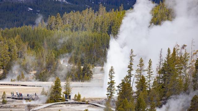
Which means the odds of it erupting the moment you open the page are low, and waiting a while pays off. An eruption lasts several minutes, so leaving the tab open may be the right approach.
This is also the only video feed among the 27 Park Service cameras on this site. Yellowstone's official page says the same: of its ten cameras, this is the one that streams video. And this camera is not maintained out of the park's budget — it is supported by a donation from Canon USA. Showing a wait-and-it-erupts camera as video costs that much. The rest are still images, like the cameras from other agencies here.
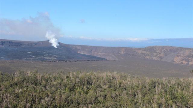
Hawaii Volcanoes National Park (Hawaii Island) is a World Heritage park containing two active volcanoes, Kilauea and Mauna Loa. What there is to see depends on what the volcano is doing, which makes it a different animal from the other parks. Cameras trained on the same island's volcanoes for monitoring purposes are covered in the article on volcano cameras.
Watch in the middle of the Japanese night
The 27 are scattered from Alaska to the east coast, 13 to 19 hours behind Japan. The 89 US cameras also include volcano and wildlife feeds. The window when they are collectively in daylight is roughly midnight to 4am Japan time. Around 8 to 10pm in Japan, the western parks are just getting their morning.
One caveat: in parks where roads close for the winter, cameras can go down because nobody can reach them for maintenance. Before listing these, we checked one by one that the images were still updating, and dropped anything that had been frozen for months. Even so, a camera may stop for a while for seasonal or maintenance reasons.
As scenic-viewpoint cameras, national park feeds may disappoint. But watch them as what they are — recording instruments — and you gain a way of looking: how far into that unremarkable ridge can I see today?