Sea
Tides: 9 Live Cameras — when the sea climbs the river
Nine cameras where the tide shows: five on rivers the sea climbs, one on a strait where it becomes a current, three on coasts where sand appears at low tide.
What you can see
The tide is not only the sea's. The lower reach of a river moves as part of the sea.
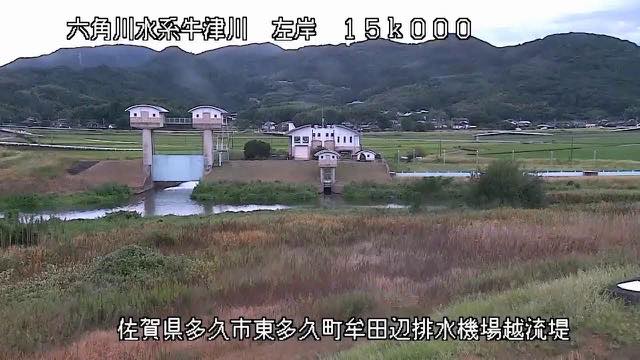
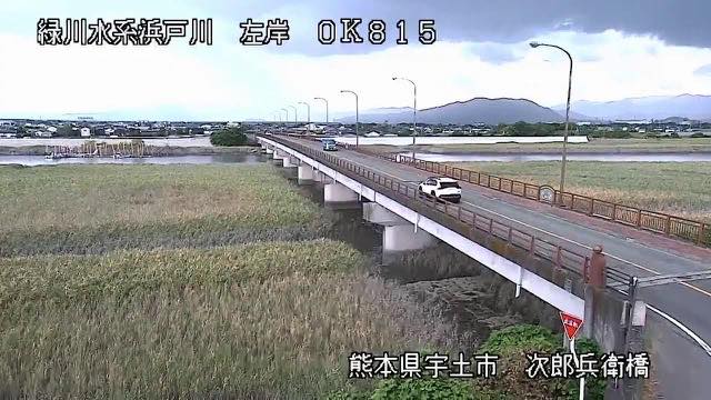
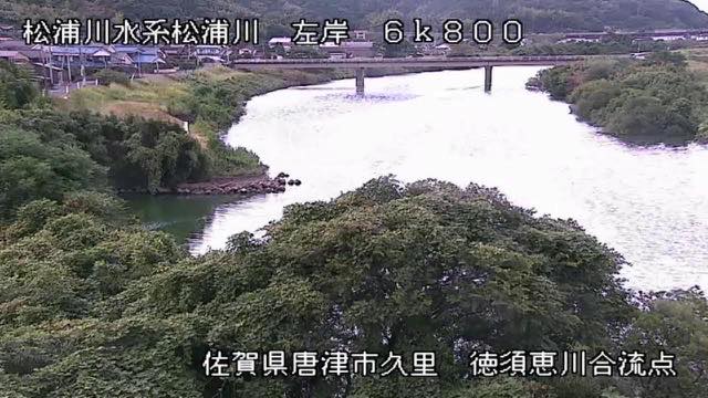
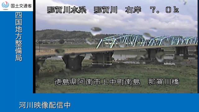
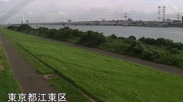
Of the five rivers the sea climbs, the Rokkaku falls so gently that the tide of the Ariake Sea runs far inland; its source notes that the muddy surface sometimes moves upstream. Watching it, you lose track of which way the river runs. The Midori reaches the same Ariake Sea, and its wide mouth flats make the river look visibly thinner at low water. The Matsuura is on the Genkai side, where a sandbar has built up near the mouth, so the tide changes the look of it. Nakagawa Bridge is close to the mouth at Anan, where the river is wide enough for the tide to reach. Shinsuna emergency wharf sits at the -0.5 km marker, the point where the Arakawa comes nearest the sea, and its level rises and falls within a single day.
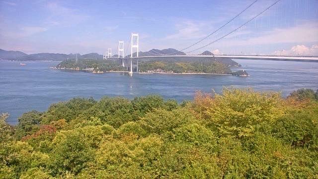
The one strait is the Kurushima Strait, one of the three fastest tidal races in Japan. Every time the tide turns, the pattern on the surface changes and large ships pass through in single file. On the other eight the water level changes; here the water itself runs.
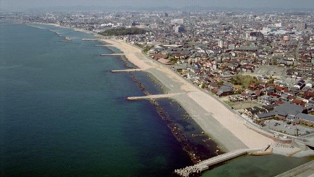
Of the three coasts, the Higashi-Harima coast is a sand beach on the Seto Inland Sea, where wave height and tide level are the thing to watch. In Korea, Hagampo is on a sea with a large tidal range, and the beach widens out to seaward when the tide drops. At Dadohaehaesang the tide changes how much sand is showing, and how clearly the far islands stand tells you how clear the air is.
These nine are gathered because one single motion takes a different form in each place: level on a river, current in a strait, width of sand on a coast.
Cameras you can watch now: 9
7 video, 2 still. Tap one to open it in the camera list.
-
 Sample September 2026
Rokkaku River
Takeo–Shiroishi, Saga · River
Its gradient is so slight that the Ariake tide pushes far inland. You can watch muddy water travel upstream.
-
 Sample September 2026
Midori River
Uto, Kumamoto · River
It runs south of the Kumamoto plain to the Ariake Sea. Broad tidal flats at the mouth make the river look visibly narrower at low tide.
-
 Sample September 2026
Matsuura River
Karatsu, Saga · River
It crosses the Karatsu plain to the Genkai Sea. Sandbars build near the mouth, and the look of it changes with the tide.
-
 Stream cover
Nakagawa Bridge
Anan, Tokushima · River
A bridge over the Nakagawa near its mouth, in the city of Anan. By here the channel is wide and the tide reaches it.
-
 Sample September 2026
Shinsuna emergency wharf
Koto, Tokyo · River
The marker here reads -0.5 km, the closest the Arakawa gets to the sea. This stretch is tidal, and the level rises and falls within the day.
-
 Sample September 2026
Kurushima Strait
Imabari, Ehime · Sea
One of Japan's three great tidal races. The pattern on the surface flips each time the tide turns, and large ships pass through in single file.
-
 Stream cover
Higashi-Harima coast
Akashi–Kakogawa, Hyogo · Sea
A sandy shore on the Seto Inland Sea. This camera shows coast rather than river, so wave height and tide are what to watch.
-
Live video
Hagampo, Taeanhaean
Taean, South Chungcheong · Sea
Sand and rock on the Yellow Sea. The tidal range is large, and at low tide the beach runs a long way out.
-
Live video
Jiri and Cheongseon shore, Dadohaehaesang
South Jeolla · Sea
A beach among the many islands of the Dadohae. The tide changes how much sand there is, and how clearly the distant islands show tells you how clear the air is.
When to watch
The clearest way is to look twice in one day. The tide rises and falls within the day, so opening the same picture a few hours apart shows a changed level or a changed width of sand. One look tells you nothing.
The five rivers are no good after rain. Water coming down from upstream beats the tide and hides it. Decisions about evacuating belong to your local authority; these cameras are for looking.
Kurushima is a still picture once an hour, so the running moment itself is never caught. You read it from the pattern on the surface and the line of ships.
The two Korean cameras are on the same clock as Japan, with no daylight saving, so unlike the Taiwanese ones there is no offset to add.
High and low water times are not published by the sources, so this page does not set them either. For tide times, see the tide tables of the Japan Meteorological Agency.
If it isn't showing
The sources are the Ministry of Land, Infrastructure, Transport and Tourism (Kyushu, Shikoku and Kinki regional bureaus, and the Arakawa Downstream River Office), the Ministry of the Environment, and the Korea National Park Service. Shinsuna refreshes every minute and Kurushima every hour. What is happening when a live camera shows nothing explains how to tell why.
Each river and sea is covered in full on its own page: The Rivers of Fukuoka and Saga (Rokkaku and Matsuura), The Rivers of Kumamoto and Nagasaki (Midori), The Naka River, The Arakawa (Shinsuna), The Seto Inland Sea (Kurushima), Rivers and Coast in Hyogo (Higashi-Harima) and US and Korean National Parks (the two Korean cameras).
For the same rivers seen from the deck of a bridge, see Bridges. The sea itself is under Sea and rivers under River.
Where to find Tides
Agencies publishing the cameras on this page
- Korea National Park Service (Public work, free use) — Official site
- MLIT Arakawa Downstream River Office (PDL 1.0) — Official site
- MLIT river live streams (Government Standard Terms 2.0) — Official site
- Ministry of the Environment — Internet Nature Institute (PDL 1.0) — Official site
The footage belongs to each agency. This site is an unofficial guide, and each sample frame was copied once per camera under that agency's terms of use.