Region
Fukushima Live Cameras in Japan — 4 official webcams
Three monitored volcanoes — Azuma, Adatara and Bandai — plus Renge Marsh on the Urabandai side. Bandai appears twice: as a volcano under watch, and as a view across water.
What you can see
Three volcanoes under constant watch by the Japan Meteorological Agency, plus one lake camera from the Ministry of the Environment. Three of the four look at the same volcanic district from different angles, which makes this a dense corner of the map.
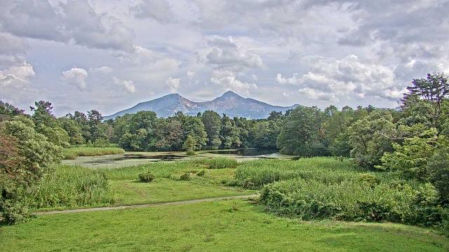
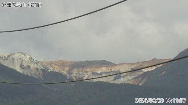
Mount Bandai lost its northern flank in the eruption of 1888, and the debris dammed the valleys to create the lakes of Urabandai. What the Renge-numa camera shows is the landscape that eruption built: pond and mountain in one frame, cause and effect in a single picture. The Oana crater on Mount Azuma and Numanotaira on Mount Adatara are both bare crater floors, sharply different in colour from the green around them.
4 cameras in Fukushima
All 4 are still images. Tap one to open it in the camera list.
-
 Sample August 2026
Lake Renge and Mount Bandai
Kitashiobara, Fukushima · Nature
One of the lakes created by the 1888 eruption. Pond and mountain sit in the same frame, and the autumn colour layers up between them.
-
 Sample August 2026
Mount Azuma
Fukushima / Yamagata border · Volcano
Crossed by the Bandai-Azuma Skyline. Oana crater near Jododaira still vents steam, and its activity rises and falls in cycles.
-
 Sample August 2026
Mount Adatara
Fukushima · Volcano · Nature
Known from a poem by Kotaro Takamura. Numanotaira, west of the summit, is a bare crater floor — a completely different colour from the green around it.
-
 Sample August 2026
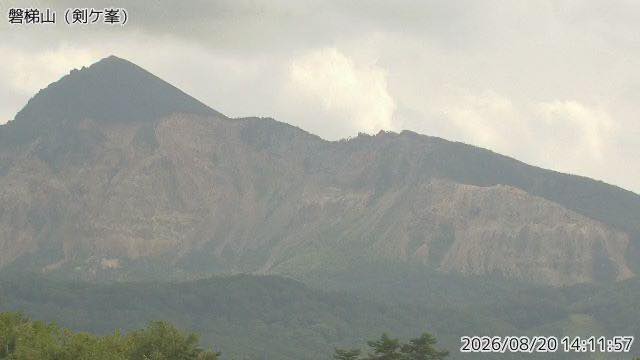
Mount Bandai
Fukushima · Volcano · Nature
The 1888 eruption collapsed the north side, and the debris dammed the valleys into the Urabandai lakes. Front and back look like two different mountains.
When to watch
Renge Marsh is one of the lakes and ponds formed when the 1888 eruption of Mount Bandai dammed the rivers. Seeing one mountain through two cameras built for entirely different purposes — a Meteorological Agency monitoring camera and an Environment Ministry scenery camera — is a rare pairing even on this site.
Autumn colour runs from mid to late October, and because Urabandai reflects it off the water, a clear, still morning is the best time. In winter all three cameras go white, which if anything makes the shape of the ground clearer.
Closer looks at cameras here
- Mount Bandai2
- JMA Volcano Watch Cameras49
- The Volcanoes of Tohoku8
- Autumn Leaves16
- First Snowcap16
- Volcanic lakes11
Agencies publishing the cameras on this page
- Japan Meteorological Agency — volcano surveillance cameras (PDL 1.0) — Official site
- Ministry of the Environment — Internet Nature Institute (PDL 1.0) — Official site
The footage belongs to each agency. This site is an unofficial guide, and each sample frame was copied once per camera under that agency's terms of use.