Volcano
Mount Bandai: 2 Live Cameras in Japan
A mountain with two entirely different faces. One camera watches it as a volcano, the other looks across a lake on the Urabandai side. The sheer scar on the north is what the 1888 eruption left.
What you can see
From the south, Bandai is a tidy cone. From the north, the scar where half the mountain slid away is fully exposed. The eruption of 1888 took off the northern half, and the debris that ran downhill dammed the rivers — which is how the scatter of lakes and ponds at Urabandai came to exist.
The Meteorological Agency camera watches it as a volcano. Renge Marsh and Mount Bandai is an Environment Ministry scenery camera, framed so you look across water made by the eruption at the collapse scar made by the same eruption. Cause and effect in one picture — a rare thing for a camera to manage.
The way the mountain gave way in 1888 became the name of a type among people who study volcanoes. A steam-driven blast triggering the sudden collapse of a mountain, sending rock and soil racing downhill, is called a Bandai-type eruption. Unlike an eruption that pours out lava, what changes here is the shape of the mountain itself. The sheer wall on the north side that the camera shows is that collapse surface, still exposed. You are looking at the cut where the mountain took its present shape in a single event.
Cameras you can watch now: 2
All 2 are still images. Tap one to open it in the camera list.
-
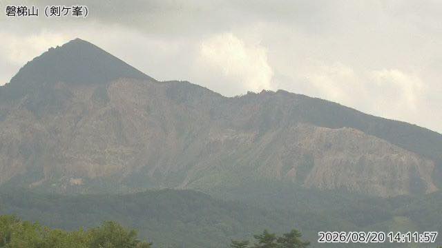 Sample August 2026
Mount Bandai
Fukushima · Volcano · Nature
The 1888 eruption collapsed the north side, and the debris dammed the valleys into the Urabandai lakes. Front and back look like two different mountains.
-
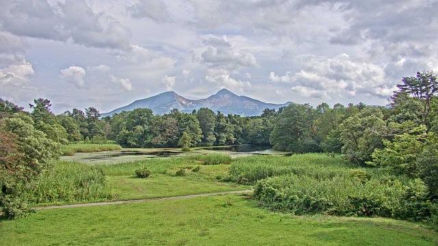 Sample August 2026
Lake Renge and Mount Bandai
Kitashiobara, Fukushima · Nature
One of the lakes created by the 1888 eruption. Pond and mountain sit in the same frame, and the autumn colour layers up between them.
When to watch
Autumn colour from late October into early November is the main event. The lakes at Urabandai are ringed with broadleaf trees, so the colour lands on the water. On a windless morning the marsh goes to mirror.
Winters here are deep. The marsh freezes and the frame reduces to more or less black and white. In spring, around May, snow is still on the mountain while the foot is coming into leaf, so the picture splits into two seasons, top and bottom.
The camera faces a direction that avoids the worst glare morning and evening, so mornings give the best modelling on the slope.
If it isn't showing
These two cameras are watching a cause and its effect. On 15 July 1888 a steam explosion brought down Ko-Bandai; the debris avalanche dammed the rivers, and some three hundred lakes and ponds formed on the northern side. Renge-numa is one of them. The mountain the Meteorological Agency watches is the mountain that made the pond the Environment Ministry films.
Both are stills and neither shows anything at night; the Renge-numa camera refreshes once an hour. The path around the pond is flat, and in summer there are water shield and pygmy water-lily flowers on it and grebes on the water — but none of that reaches the screen. What you get is the surface, and the mountain behind it.
Fukushima also has cameras on Mount Azuma and Mount Adatara, collected under The Volcanoes of Tohoku. If you are waiting for October, both of these appear under Autumn Leaves too.
Where to find Mount Bandai
Agencies publishing the cameras on this page
- Japan Meteorological Agency — volcano surveillance cameras (PDL 1.0) — Official site
- Ministry of the Environment — Internet Nature Institute (PDL 1.0) — Official site
The footage belongs to each agency. This site is an unofficial guide, and each sample frame was copied once per camera under that agency's terms of use.