River
The Arakawa in Adachi: 2 Live Cameras in Japan
The stretch of the Arakawa through Adachi, held by two Ministry of Land cameras that refresh every minute: Nishiarai Bridge at 13.8km and Goshikizakura at 17.1km.
What you can see
These are the two cameras on the stretch of the Arakawa that runs through Adachi. From upstream down: Goshikizakura Bridge (17.1km from the mouth) and the water above Nishiarai Bridge (13.8km).
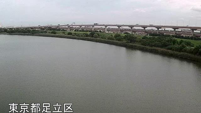
Goshikizakura Bridge is a double-deck bridge carrying the Kawaguchi expressway over the river. The two carriageways are stacked one above the other, so from the side the girders read as two tiers. At night the lights on the piers run out long across the water.
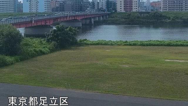
The Nishiarai camera looks upstream from the left bank, and a red bridge crosses the frame with apartment towers standing behind it. The near part of the picture is wide mown riverbank.
This part of the Arakawa was dug by hand between the end of the Meiji era and the early Showa era. Everything below Iwabuchi Floodgate is called the Arakawa floodway, and Adachi sits on that section. That is why the channel is so wide and so straight.
Both cameras refresh every minute, and each picture has the place name burnt into the bottom left, so you can tell which view you are looking at without leaving the page.
Cameras you can watch now: 2
All 2 are still images. Tap one to open it in the camera list.
-
 Sample August 2026
Above Nishiarai Bridge
Adachi, Tokyo · River
13.8 km from the mouth, looking upstream of Nishiarai Bridge from the left bank. Tower blocks line the far side and the water picks up their lights.
-
 Sample August 2026
Goshikizakura Bridge
Adachi, Tokyo · River
17.1 km from the mouth. A double-deck bridge carrying the Kawaguchi expressway over the river; at night the pier lighting stretches across the water.
When to watch
These are most useful in heavy rain and typhoons. The riverbank that is normally open ground goes under from the bottom up as the water rises. Open the two in order from upstream and you can see how far it has come. But decide whether to evacuate from what your local authority says. The rougher the day, the darker the screen, and raindrops blur the lens.
On calm days, morning and evening. The river runs north to south, so the water blows out white in the middle of the day; in low light you can see across to the far bank.
In winter the air is clear, and on some days the towers of central Tokyo line up beyond the levee. On summer evenings you see people out on the riverbank.
If it isn't showing
All ten cameras from the upper river to the mouth are gathered in The Arakawa. Just upstream is Iwabuchi Floodgate, and just downstream Horikiri.
Cameras with a bridge in the frame are in Bridges, and the cameras of the same prefecture in Tokyo.
Every river camera is in River, and the article is Why river cameras exist.
Where to find The Arakawa in Adachi
Agencies publishing the cameras on this page
- MLIT Arakawa Downstream River Office (PDL 1.0) — Official site
The footage belongs to each agency. This site is an unofficial guide, and each sample frame was copied once per camera under that agency's terms of use.