Region
Nagasaki Live Cameras in Japan — 2 official webcams
Mount Unzen, and a river camera on the Hommyo. Unzen built a lava dome during the eruptions that began in 1990, and the Meteorological Agency still watches it around the clock.
What you can see
One volcano camera from the Japan Meteorological Agency and one river camera from the Ministry of Land, Infrastructure, Transport and Tourism.
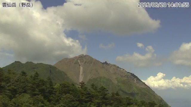
The Unzen camera looks at the massif that includes Heisei-shinzan, the dome built by the eruptions that began in 1990. The tracks left by the pyroclastic flows are still visible, and the camera watches from the Nodake side. Lava domes are prone to collapse, which is exactly why the watch continues.
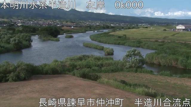
The Honmyo is a short river cutting through the middle of Isahaya. The 1957 Isahaya flood disaster is why a river this short is watched this closely.
Part of the mountain in front of the Unzen camera is brand-new ground. Through the eruption that ran from 1990 to 1995 a lava dome grew there, and it was named Heisei-shinzan. At 1,483 m it is now the highest point in Nagasaki Prefecture — the prefecture's high point came into being within living memory. The Shimabara Peninsula is itself the work of this volcano, and it is recognised as a UNESCO Global Geopark as a place where you can read how the land was made.
2 cameras in Nagasaki
1 video, 1 still. Tap one to open it in the camera list.
-
 Sample August 2026
Mount Unzen
Shimabara, Nagasaki · Volcano
The eruption that began in 1991 built the peak now called Heisei Shinzan. The paths the pyroclastic flows took are still visible; the camera looks from Nodake.
-
 Sample August 2026
Honmyo River
Isahaya, Nagasaki · River
A short river through central Isahaya. Because of the 1957 flood disaster, it is watched especially closely.
When to watch
The Unzen camera points at the massif that includes Heisei-Shinzan, the peak thrown up by the eruption of the Heisei era. Lava domes collapse easily, which is precisely why the watch continues.
The Shimabara Peninsula is ringed by sea, so cloud builds readily and the summit is hidden on plenty of days. The dry air of a winter pressure pattern gives the sharpest outline.
Closer looks at cameras here
Agencies publishing the cameras on this page
- Japan Meteorological Agency — volcano surveillance cameras (PDL 1.0) — Official site
- MLIT river live streams (Government Standard Terms 2.0) — Official site
The footage belongs to each agency. This site is an unofficial guide, and each sample frame was copied once per camera under that agency's terms of use.