Region
Okayama Live Cameras in Japan — 10 official webcams
Nine river live streams from the transport ministry, plus the Seto Inland Sea from Washuzan. The three great rivers of Okayama, seen at the weirs and gates where people have had a hand in them.
What you can see
Nine of these are river live streams from the Chugoku bureau of the transport ministry; the tenth is Washuzan, run by the Ministry of the Environment. Each stream holds one fixed point, so there is nothing to wait for.
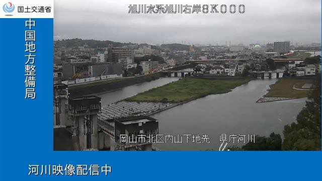
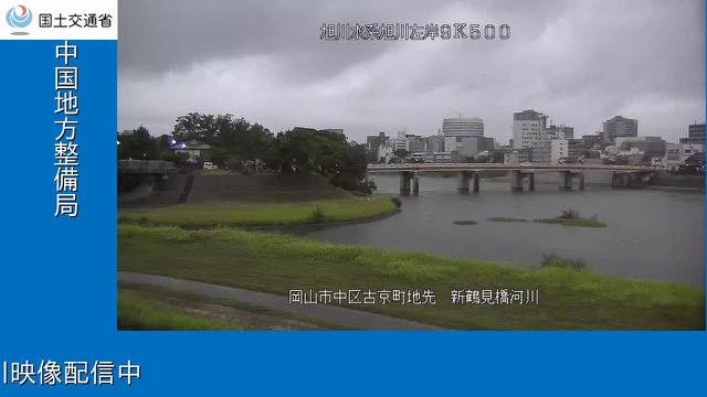
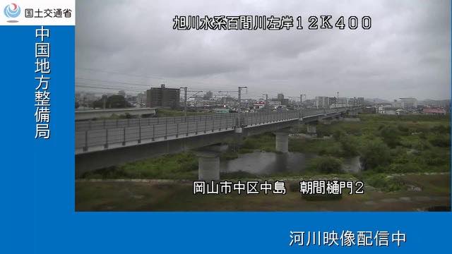
The nine divide among what Okayama calls its three great rivers. In the middle, the Asahi carries a camera in front of the prefectural office, just below Okayama Castle, and another about a kilometre upstream at Shintsurumi Bridge. The Hyakken, in the same system, is a channel opened in the Edo period to take Asahi water only during floods; one camera sits on its sluice gate, and most of the time the frame holds very little water.
In the west, the Takahashi is watched at the Sakazu intake weir, where the water drawn off becomes the irrigation supply of the Kurashiki plain. Two more sit on its tributary the Oda: the river whose downstream district of Mabi went under water in the rains of 2018, after which work to move its junction with the Takahashi went ahead.
In the east, the Yoshii has one camera at Oyasumi and one just below the Shintabarai weir. The camera on its tributary the Kongo stands less than four kilometres from that weir.
Five of the nine are mounted on structures — weirs, intake weirs, sluice gates. Okayama's rivers carry both the works that ration water under the low rainfall of the Inland Sea side and the works that let floods escape, often in the same basin, and where the cameras sit shows it.
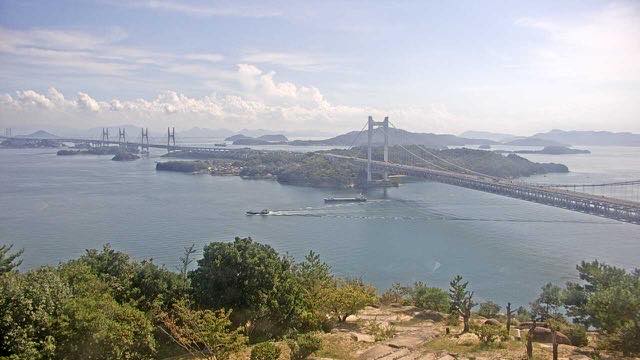
The last camera, Washuzan, is sea rather than river: from the southern tip of the Kojima peninsula it looks down on the islands of the Inland Sea and the Great Seto Bridge.
10 cameras in Okayama
9 video, 1 still. Tap one to open it in the camera list.
-
 Sample September 2026
Seto Inland Sea from Mount Washu
Kurashiki, Okayama · Sea · Nature
A lookout known for its scatter of islands. The Great Seto Bridge overlaps the island silhouettes, and evening backlight sets the water shining.
-
 Stream cover
Asahi River at the prefectural office
Okayama · River
The Asahi River where it runs just below Okayama Castle, on the reach in front of the prefectural office. A city river shown as it is.
-
 Stream cover
Asahi River, Shintsurumi Bridge
Okayama · River
A watch camera on Shintsurumi Bridge over the Asahi River, about a kilometre upstream of the one at the prefectural office.
-
 Stream cover
Hyakken floodway gate
Okayama · River
A sluice gate on the Hyakken, a channel opened in the Edo period to carry Asahi River water only during floods. Most of the time there is little water in it.
-
 Stream cover
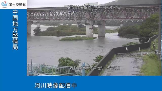
Takahashi River, Sakazu weir
Okayama · River
The intake weir that dams the Takahashi River at Sakazu. Water drawn off here becomes the irrigation supply of the Kurashiki plain.
-
 Stream cover
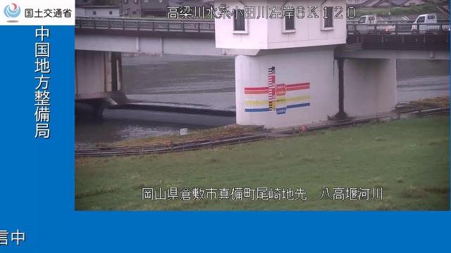
Oda River, upper weir
Okayama · River
A weir on the Oda River, which joins the Takahashi. Mabi, downstream, went under water in the rains of 2018, and work to move the junction followed.
-
 Stream cover
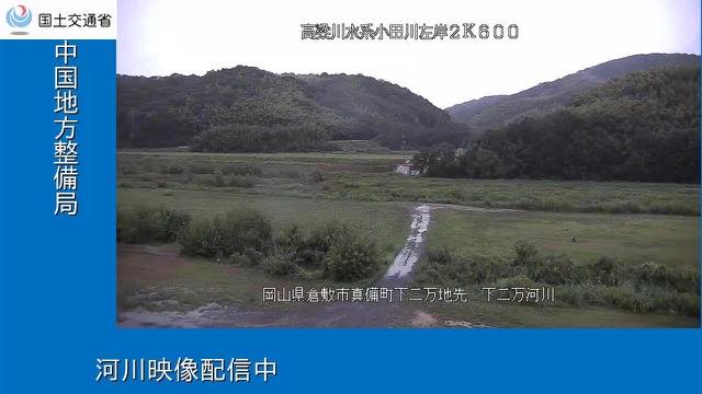
Oda River, lower camera
Okayama · River
A camera further down the Oda River, some three kilometres below the weir camera and closer to the junction with the Takahashi.
-
 Stream cover
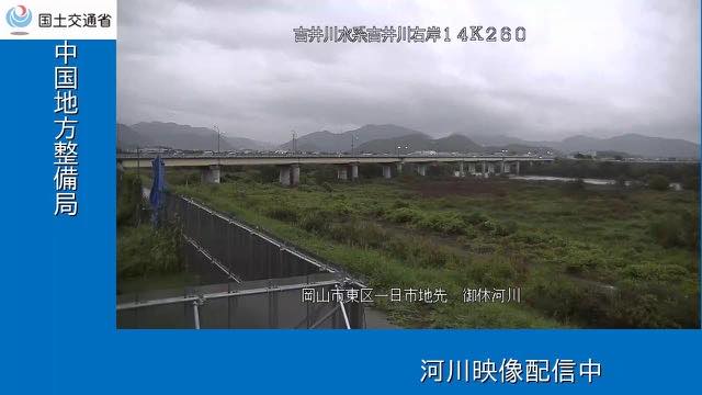
Yoshii River, lower gauge
Okayama · River
A water-level station on the Yoshii River in eastern Okayama. Of the ministry's two cameras on this main stem, this is the one nearer the mouth.
-
 Stream cover
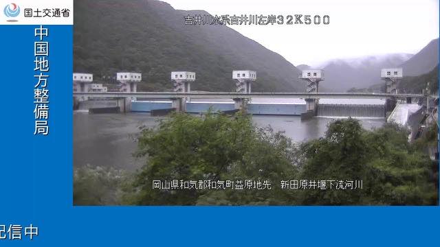
Yoshii River, below the weir
Okayama · River
The reach immediately below the Shintabarai weir, which dams the Yoshii River. How the water falls away from the weir is visible here.
-
 Stream cover
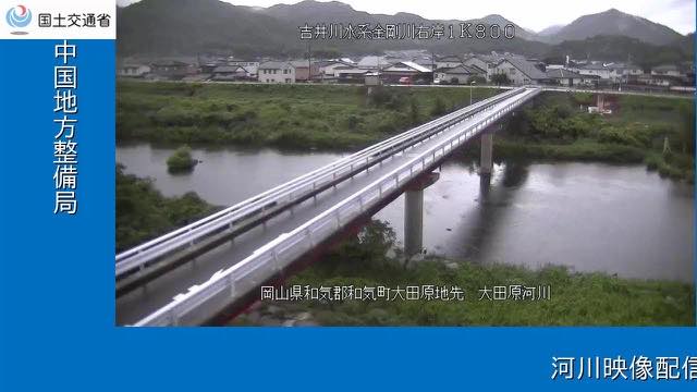
Kongo River camera
Okayama · River
A camera on the Kongo River, which joins the Yoshii. It is less than four kilometres from the main- stem camera at the weir.
When to watch
The nine river cameras move most from June to July, in the rainy season, and from August to September, when the typhoons come. The Inland Sea side gets little rain over the year, which makes the change during a real downpour all the more obvious. The weir cameras look completely different depending on whether water is being held or let down.
At Washuzan the sun sets beyond the Great Seto Bridge in the evening. On a clear day with settled air the islands line up far into the distance.
Closer looks at cameras here
Agencies publishing the cameras on this page
- MLIT river live streams (Government Standard Terms 2.0) — Official site
- Ministry of the Environment — Internet Nature Institute (PDL 1.0) — Official site
The footage belongs to each agency. This site is an unofficial guide, and each sample frame was copied once per camera under that agency's terms of use.