Category
River: 134 Live Cameras
Cameras the transport ministry keeps on Japan's major rivers. The water is usually calm — the value is in watching the same frame when heavy rain arrives.
What you can see
River cameras are flood-control equipment. Regional bureaus of the Ministry of Land, Infrastructure, Transport and Tourism run them on the major stretches of Japan's Class A rivers — the ones the national government manages directly. Each is aimed so that levees, bridge piers and floodgates appear in frame: not the prettiest angle, but the angle from which you can read the water level.
Which is why they are worth watching in ordinary weather. Once you know where the surface normally sits, opening the same camera during heavy rain tells you how far it has risen at a glance — faster than any number could.
Six of the regional bureaus — Hokkaido, Kanto, Hokuriku, Kansai, Shikoku and Kyushu — run their cameras as live video on YouTube rather than stills. Most cycle through several cameras so that one stream covers many points on a catchment. Shikoku is the exception: its streams hold a single spot, and some of them look straight at the outlet where a dam lets its water go. They are trial broadcasts and can stop without notice.
Cameras you can watch now: 134
122 video, 12 still. Tap one to open it in the camera list.
Hokkaido2
Tochigi1
Gunma2
- Watarase RiverGunma–TochigiLive video, rotating
- Tone and Karasu riversGunma–SaitamaLive video, rotating
Saitama3
- Ara and Iruma riversSaitama–TokyoLive video, rotating
- Sasame BridgeToda, SaitamaStill, every minute
- Shin-Arakawa BridgeKawaguchi, SaitamaStill, every minute
Tokyo8
- Iwabuchi FloodgateKita, TokyoStill, every minute
- Goshikizakura BridgeAdachi, TokyoStill, every minute
- Above Nishiarai BridgeAdachi, TokyoStill, every minute
- Horikiri emergency wharfKatsushika, TokyoStill, every minute
- Above Hirai BridgeEdogawa, TokyoStill, every minute
- Below Metropolitan Expressway Route 7Edogawa, TokyoStill, every minute
- Komatsugawa emergency wharfEdogawa, TokyoStill, every minute
- Shinsuna emergency wharfKoto, TokyoStill, every minute
Niigata3
- Ara and Agano river systemsNiigata–FukushimaLive video, rotating
- Shinano river systemNiigata–NaganoLive video, rotating
- Seki, Hime and Kurobe river systemsNiigata–ToyamaLive video, rotating
Toyama1
Ishikawa1
Fukui2
Yamanashi1
Mie1
Shiga1
Kyoto4
- Yura RiverFukuchiyama–Maizuru, KyotoLive video, rotating
- Katsura RiverArashiyama, KyotoLive video, rotating
- Kizu Riversouthern KyotoLive video, rotating
- Arashiyama, north end of Togetsukyo bridgeUkyo, KyotoLive video
Hyogo4
- Ina and Mo RiversHyogo / OsakaLive video, rotating
- Maruyama and Izushi RiversToyooka, HyogoLive video, rotating
- Kako and Manganji RiversKakogawa, HyogoLive video, rotating
- Ibo and Hayashida RiversHimeji, HyogoLive video, rotating
Nara1
Wakayama2
- Kino and Kishi RiversWakayamaLive video, rotating
- Kumano and Ainotani RiversWakayama / MieLive video, rotating
Tottori9
- Sendai River, lower gaugeTottoriLive video
- Sendai River, middle gaugeTottoriLive video
- Sendai River, upper gaugeTottoriLive video
- Tenjin River, field officeTottoriLive video
- Ogamo River gaugeTottoriLive video
- Ko River gaugeTottoriLive video
- Hino River, lower gaugeTottoriLive video
- Hosshoji River gaugeTottoriLive video
- Hino River, upper gaugeTottoriLive video
Shimane9
- Hii River, lower gaugeShimaneLive video
- Hii River, raised bedShimaneLive video
- Kando River gaugeShimaneLive video
- Gono River, middle gaugeShimaneLive video
- Gono River, nearest the mouthShimaneLive video
- Gono River, Tsuga BridgeShimaneLive video
- Takatsu River, lower gaugeShimaneLive video
- Takatsu River, upper gaugeShimaneLive video
- Hikimi River gaugeShimaneLive video
Okayama9
- Asahi River at the prefectural officeOkayamaLive video
- Asahi River, Shintsurumi BridgeOkayamaLive video
- Hyakken floodway gateOkayamaLive video
- Takahashi River, Sakazu weirOkayamaLive video
- Oda River, upper weirOkayamaLive video
- Oda River, lower cameraOkayamaLive video
- Yoshii River, lower gaugeOkayamaLive video
- Yoshii River, below the weirOkayamaLive video
- Kongo River cameraOkayamaLive video
Hiroshima9
- Ota River below Asa BridgeHiroshimaLive video
- Nenotani River, Shinkawa BridgeHiroshimaLive video
- Misasa River drainage gateHiroshimaLive video
- Basen River gaugeHiroshimaLive video
- Basen River, second cameraHiroshimaLive video
- Gono River, Bishamon BridgeHiroshimaLive video
- Ashida River in FukuyamaHiroshimaLive video
- Ashida River in FuchuHiroshimaLive video
- Takaya River at the waterworksHiroshimaLive video
Yamaguchi6
- Saba River, 24.7 kmYamaguchiLive video
- Saba River, 23.2 kmYamaguchiLive video
- Saba River, 6.4 kmYamaguchiLive video
- Oze River, Nakaichi weirYamaguchi / Hiroshima borderLive video
- Oze River, warning stationYamaguchi / Hiroshima borderLive video
- Oze River, field officeYamaguchi / Hiroshima borderLive video
Tokushima4
- Nagayasuguchi Dam, just downstreamNaka, TokushimaLive video
- Nakagawa BridgeAnan, TokushimaLive video
- Choseibashi BridgeAnan, TokushimaLive video
- KamodaniAnan, TokushimaLive video
Ehime3
- Nomura Dam, just downstreamSeiyo, EhimeLive video
- Kanogawa Dam outlet gateOzu, EhimeLive video
- Hijikawa BridgeOzu, EhimeLive video
Fukuoka4
- Onga RiverChikuho, FukuokaLive video, rotating
- Yamakuni RiverFukuoka / Oita borderLive video, rotating
- Chikugo RiverFukuoka / Saga / OitaLive video, rotating
- Yabe RiverYame, FukuokaLive video, rotating
Saga3
- Matsuura RiverKaratsu, SagaLive video, rotating
- Rokkaku RiverTakeo–Shiroishi, SagaLive video, rotating
- Kase RiverSagaLive video, rotating
Nagasaki1
Kumamoto4
- Kikuchi RiverTamana, KumamotoLive video, rotating
- Shira RiverKumamotoLive video, rotating
- Midori RiverUto, KumamotoLive video, rotating
- Kuma RiverHitoyoshi, KumamotoLive video, rotating
Oita3
- Oita RiverOitaLive video, rotating
- Ono RiverOitaLive video, rotating
- Bansho RiverSaiki, OitaLive video, rotating
Miyazaki3
- Gokase RiverNobeoka, MiyazakiLive video, rotating
- Komaru RiverTakanabe, MiyazakiLive video, rotating
- Oyodo RiverMiyazakiLive video, rotating
Kagoshima2
- Sendai RiverKagoshima / MiyazakiLive video, rotating
- Kimotsuki RiverOsumi Peninsula, KagoshimaLive video, rotating
United States16
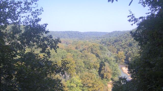
- Mammoth Cave National ParkKentuckyStill image
- New River Gorge National ParkWest VirginiaStill image
- Brown bears at Brooks Falls (Katmai)Alaska, Katmai National ParkLive video, late June-July
- Lower Brooks River, at Naknek LakeAlaska, Katmai National ParkLive video, Sept-Oct
- The Riffles, below Brooks FallsAlaska, Katmai National ParkLive video, September
- Brooks River watch (two angles)Alaska, Katmai National ParkLive video
- Naknek River at King SalmonAlaska, King SalmonLive video
- Anan Creek black bears 1 (Tongass)Alaska, WrangellLive video, July-August
- Anan Creek black bears 2 (fishing styles)Alaska, WrangellLive video, July-August
- Anan Creek fishing hole 4Alaska, WrangellLive video, July-August
- Castle Rock peregrine falcons (Mississippi)Wisconsin, Fountain CityLive video
- Great Spirit Bluff peregrine falconsMinnesota, La CrescentLive video
- Mississippi FlywayWisconsin, Brice PrairieLive video
- Sandhill cranes on the Platte (Rowe Sanctuary)Nebraska, GibbonLive video, dawn and dusk
- Redwoods and the Smith RiverCalifornia, Crescent CityLive video
- Underwater at Silver Springs (manatees)Florida, Silver Springs State ParkLive video
Taiwan4
- WulingShei-Pa, TaichungLive video
- BasianshanBasianshan, TaichungLive video
- ManyueyuanManyueyuan, New TaipeiLive video
- NeidongNeidong, New TaipeiLive video
South Africa2
Kenya3
- The Mpala riverLaikipiaLive video
- Mara River main crossingMara TriangleLive video
- Fig Tree crossing on the MaraMara TriangleLive video
Osaka1
Ibaraki1
Chiba1
When to watch
June to October is flood season — the rainy front and the typhoons both land in that window, and that is when these cameras earn their keep. But when it is genuinely dangerous, do not watch a camera: follow the evacuation guidance from your local authority. This site is a directory, not a disaster information source.
Other seasons have their own interest. Snowmelt in early spring raises some rivers; the dry winter months expose wide gravel bars on others. On the Chikugo, which empties into the Ariake Sea, the tide reaches so far upstream that the lower river reverses direction twice a day.
Daylight only. Most river cameras carry no lighting, so after sunset the frame is simply black.
Browse by subject
- Iwabuchi Floodgate1
- Sasame Bridge1
- Shin-Arakawa Bridge1
- The Arakawa in Adachi2
- Horikiri1
- The Arakawa in Edogawa3
- The Arakawa in Koto1
- The Arakawa10
- The Yodo River System6
- The Rivers of Fukuoka and Saga7
- The Rivers of Kumamoto and Nagasaki5
- The Rivers of Oita3
- Rivers of Miyazaki and Kagoshima5
- The Rivers of the Kii Peninsula2
- Rivers and Coast in Hyogo4
- Autumn Leaves16
- The Yura River1
- The Yamato River1
- The Kuzuryu River1
- Brooks Falls Bears and Salmon5
- Anan Creek Black Bears4
- African Rivers4
- Peregrine Falcons3
- Migration Flyways3
- Florida Waters2
- Wide Views of the US3
- Lisbon Falls1
- Shei-Pa, Taiwan4
- Taiwan's Waterfalls3
- Appalachian Parks3
- Mammoth Cave1
- Arashiyama and Sagano5
- The Rivers of the Kanto Plain6
- The Hokuriku and Shinetsu Rivers5
- The Rivers of Hokkaido2
- The Fuji River1
- The Hijikawa River3
- The Naka River4
- The Gono River6
- The Sendai River3
- The Tenjin River System3
- The Hino River3
- The Hii and Kando Rivers3
- The Takatsu River3
- The Asahi River System3
- The Takahashi River System3
- The Yoshii River System3
- The Ota River System3
- The Ashida River System3
- The Saba River3
- The Oze River3
- Fukui's towns and coast5
- Dams and weirs8
- Tides9
- Bridges20
- Snow23
- Seas of Clouds and Fog13
- Sunrise and Sunset13
Agencies publishing the cameras on this page
- FBC Fukui Broadcasting (Links free, no reuse) — Official site
- Kyoto City Tourism Association (Links free, no reuse) — Official site
- MLIT Arakawa Downstream River Office (PDL 1.0) — Official site
- MLIT river live streams (Government Standard Terms 2.0) — Official site
- Shei-Pa National Park (Taiwan open government data) — Official site
- Taiwan Forestry and Nature Conservation Agency (Taiwan open government data) — Official site
- U.S. National Park Service (U.S. government work) — Official site
- explore.org (Deep links and embeds OK, no image reuse) — Official site
The footage belongs to each agency. This site is an unofficial guide, and each sample frame was copied once per camera under that agency's terms of use.