River
The Rivers of the Kii Peninsula: 2 Live Cameras in Japan
Two rivers draining the wettest mountains in Japan, on government live streams: the Kinokawa, rising at Odaigahara, and the Kumano, which is itself part of a World Heritage pilgrimage route.
What you can see
The interior of the Kii Peninsula is one of the wettest places in Japan. Rainfall around Odaigahara is extraordinary, and the water has only a short distance to fall to the sea, which makes these rivers that come up very fast after rain.
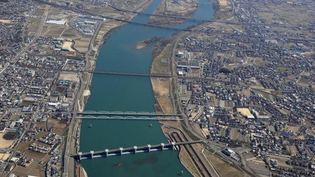
The Kinokawa rises at Odaigahara, is called the Yoshino while it is in Nara, becomes the Kinokawa on crossing into Wakayama, and empties into the Kii Channel. Orchards line the basin and river terraces step down through the frame. The Kishi, a tributary, is on the same feed.
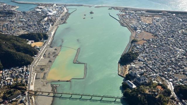
The Kumano is unusual in that the river itself is part of a World Heritage site, the Sacred Sites and Pilgrimage Routes in the Kii Mountain Range. Pilgrims heading for Kumano once travelled down it by boat. Long gorge sections give you frame after frame of close-pressed banks. The Onodani, a tributary, is on the same feed.
In Typhoon Talas in 2011 the mountains of this peninsula failed from deep below the surface, and the debris dammed rivers. The reason these rivers are watched so closely is that a disaster on that scale has actually happened here.
Both are rotating streams cycling through several points along the river.
Cameras you can watch now: 2
All 2 are live video. Tap one to open it in the camera list.
-
 Stream cover
Kino and Kishi Rivers
Wakayama · River
Rising at Odaigahara in Nara and reaching the Kii Channel. Orchards line the basin, and the river terraces show up as steps.
-
 Stream cover
Kumano and Ainotani Rivers
Wakayama / Mie · River · World Heritage
The river the World Heritage Kumano pilgrimage routes cross. Pilgrims once travelled it by boat, and long sections run through gorge.
When to watch
Typhoons. The Kii Peninsula faces south and takes the wet air off the Pacific head-on. When the rain concentrates on the southeastern slopes, the Kumano moves first.
The worse the weather, the darker the image and the more the lens smears. Take evacuation decisions from your local authority, not from a camera.
For calm days, spring and autumn suit these best. The Kinokawa basin is orchard country, so the frame changes colour at blossom and again at harvest. In the Kumano gorge there are mornings when fog lifts out of the valley.
In winter the flow drops and bare rock shows widely along the Kumano — on some days it runs so thin that it is hard to believe pilgrims came down it by boat.
If it isn't showing
Both are rotating streams that cycle through several cameras along the river. You wait for the point you want to come up, and you cannot choose which one appears when. At night it is dark, and the rougher the day the more water sits on the lens.
Both also appear on the Wakayama page. The Kumano runs along the border with Mie, but each river is counted under the first prefecture listed for it, so it does not appear on the Mie page.
These two are the only rivers of the Kii Peninsula here. The basins to the north are on The Yodo River System and The Yamato River. The Kino is called the Yoshino in Nara, and the camera on Mount Yoshino stands above its upper reaches.
Where to find The Rivers of the Kii Peninsula
Agencies publishing the cameras on this page
- MLIT river live streams (Government Standard Terms 2.0) — Official site
The footage belongs to each agency. This site is an unofficial guide, and each sample frame was copied once per camera under that agency's terms of use.