Region
Norway Live Cameras — 5 official webcams
Five observation cameras from the Norwegian Meteorological Institute: a mountain plateau in the south, islands inside the Arctic Circle, and Bjørnøya at 74 degrees north. Stills.
What you can see
All five belong to the Norwegian Meteorological Institute (Meteorologisk institutt). They hang on observation stations and test sites, so they are there to confirm what the weather is doing rather than to show a view. They are stills, not video.
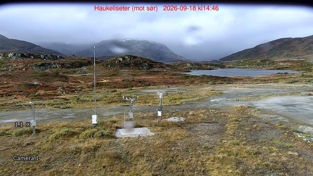
Only Haukeliseter is in the south. It is a test field at 991 m on a mountain plateau where the institute works out how to measure snow correctly in wind, and every post and box in the frame is a precipitation gauge. Lake Ståvatn and the ridges behind it fill the distance.
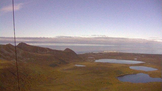
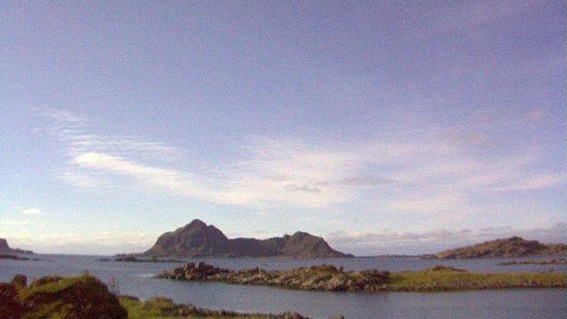
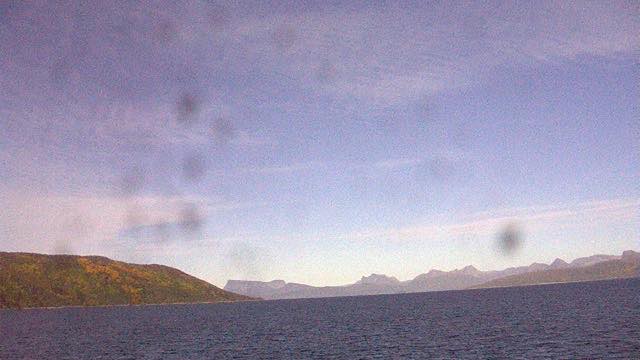
The other four are inside the Arctic Circle. Trolltinden on Andøya and Bø in Vesterålen sit at 69 degrees north, facing the open sea: treeless ground and the horizon of the Norwegian Sea. Drag in Hamarøy looks up Tysfjord instead, with the far slope standing straight ahead.
Bjørnøya is the odd one out. The island lies at 74 degrees north, halfway between the mainland and Spitsbergen, and has been staffed by people measuring the weather since 1923; the whole island is a nature reserve. Fog is common, and some days the picture is a single sheet of white.
5 cameras in Norway
All 5 are still images. Tap one to open it in the camera list.
-
 Sample September 2026
Haukeliseter, looking south
Vinje, Telemark · Nature
A test field for the institute's instruments, on a mountain plateau at 991 m. This is where they work out how to measure snow correctly in wind, so every post and box in the frame is a precipitation gauge. Lake Ståvatn and the ridges lie beyond.
-
 Sample September 2026
Trolltinden, Andøya, looking west
Andøya, Nordland · Nature · Sea
Looking west from a summit at 69 degrees north, on the island at the top end of Vesterålen. Treeless upland with small ponds scattered across it, and past them the horizon of the Norwegian Sea.
-
 Sample September 2026
Bø in Vesterålen, looking southeast
Bø, Nordland · Sea · Nature
From a settlement on the open-sea side of Vesterålen, out over water scattered with islands and skerries. Low rock and grass in front, then steep islands stacked behind one another.
-
 Sample September 2026
Drag, Hamarøy, looking northeast
Hamarøy, Nordland · Nature · Sea
From a village on Tysfjord, pointed up the fjord toward the mountains at its head. The far slope turns yellow in autumn. This is also a centre of Lule Sámi culture.
-
Still image
Bjørnøya, looking east
Bjørnøya, Svalbard · Nature · Sea
An island at 74 degrees north, halfway between the mainland and Spitsbergen. The station has been staffed by people measuring the weather since 1923, and the whole island is a nature reserve. Fog is common, and some days the frame is a single sheet of white.
When to watch
Norway is eight hours behind Japan, seven during summer time. Local noon is 20:00 in Japan, or 19:00 in summer, so evening and night in Japan is daytime there. Open them in the Japanese morning and it is night in Norway.
Four of the five are inside the Arctic Circle, so the length of the day swings hard. At 69 degrees north, Andøya and Bø get no sunrise at all from early winter to the middle of January, and from late May to late July the sun does not set. Bjørnøya at 74 degrees north swings wider still: November to early February is polar night. In winter, expect the northern four to be no brighter than twilight even at local noon.
Haukeliseter, at about 60 degrees north, changes much the way Hokkaido does.
The source does not publish a viewing season, so we do not set one here. These are cameras for seeing the sky as it is now, not for catching the aurora.
Agencies publishing the cameras on this page
- Norwegian Meteorological Institute (NLOD / CC BY 4.0) — Official site
The footage belongs to each agency. This site is an unofficial guide, and each sample frame was copied once per camera under that agency's terms of use.