River
The Arakawa in Edogawa: 3 Live Cameras in Japan
Three cameras on the Arakawa through Edogawa, refreshed every minute. Komatsugawa at 2.4km from the mouth, the Route 7 expressway at 4.3km, Hirai Bridge at 6.4km.
What you can see
These are the three cameras on the stretch of the Arakawa that runs through Edogawa. Nearest the mouth first: the Komatsugawa emergency wharf (2.4km from the mouth), below the Route 7 expressway (4.3km), and above Hirai Bridge (6.4km).
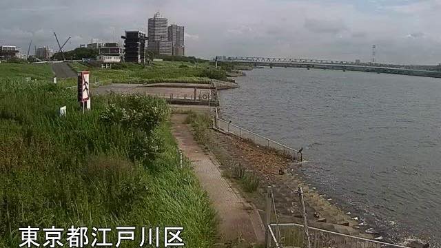
Komatsugawa is an emergency wharf. If an earthquake or another disaster puts the roads out of use, the river is used in place of a road to move people and supplies. The Arakawa has three of them, at Horikiri, Komatsugawa and Shinsuna. The frame holds river on the left and a grassy slope on the right, and the towers of central Tokyo stand behind the far bank, with a blue bridge crossing.
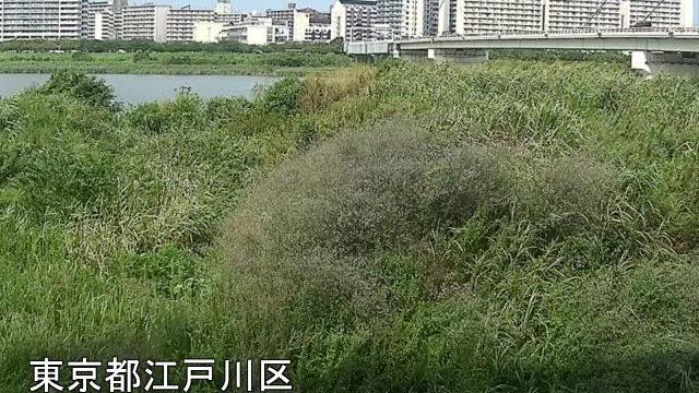
The Route 7 camera is filled to the edges with a high bank thick with reeds, and the river is only a thin band near the top. The elevated Route 7 Komatsugawa expressway crosses on the right and apartment blocks line the far bank. Of the three, this is the one where grass outweighs water.
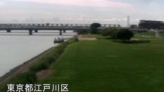
The Hirai Bridge camera looks upstream from low on the levee. The viewpoint is low, so the width of the river comes through as width in the frame. A long bridge crosses the picture and the near ground is mown riverbank.
The mouth is close here, so the sea's tide reaches this stretch. Even with no rain, the water level rises and falls over the course of a day.
All three are replaced every minute, with the place name burnt into the bottom left.
Cameras you can watch now: 3
All 3 are still images. Tap one to open it in the camera list.
-
 Sample August 2026
Komatsugawa emergency wharf
Edogawa, Tokyo · River
2.4 km from the mouth. Central Tokyo's towers stand beyond the far bank, and on a clear day their outlines are sharp.
-
 Sample August 2026
Below Metropolitan Expressway Route 7
Edogawa, Tokyo · River
4.3 km from the mouth, downstream of where Route 7 crosses. The near bank is high floodplain thick with reeds.
-
 Sample August 2026
Above Hirai Bridge
Edogawa, Tokyo · River
6.4 km from the mouth, looking upstream of Hirai Bridge from the right-bank levee. The low viewpoint puts the full width of the river on screen.
When to watch
Most useful in heavy rain and typhoons. This is well down the Arakawa's ten cameras, so the water rises here later than at Sasame Bridge or Iwabuchi upstream. If the riverbank is going under up there, the same will work its way down to here. But decide whether to evacuate from what your local authority says. The rougher the day, the darker the screen, and raindrops blur the lens.
On calm days, morning and evening. The river runs north to south, so the water blows out white in the middle of the day; in low light you can see across to the far bank.
In winter the air is clear, and on some days the towers of central Tokyo stand out sharply behind the Komatsugawa frame. On summer evenings you see people out on the riverbank.
If it isn't showing
All ten cameras from the upper river to the mouth are gathered in The Arakawa. Just upstream is Horikiri, further up The Arakawa in Adachi, and just downstream The Arakawa in Koto.
Cameras where the tide shows are in Tides, and the cameras of the same prefecture in Tokyo.
Every river camera is in River, and the article is Why river cameras exist.
Where to find The Arakawa in Edogawa
Agencies publishing the cameras on this page
- MLIT Arakawa Downstream River Office (PDL 1.0) — Official site
The footage belongs to each agency. This site is an unofficial guide, and each sample frame was copied once per camera under that agency's terms of use.