Category
Volcano: 96 Live Cameras
Sakurajima, Mount Aso, Mount Asama, Mount Ontake, Mount Fuji: the cameras Japan's weather agency points at active summits, watching for eruptions all day.
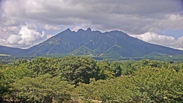
What you can see
Japan has this many mountains under live camera not for tourism. The Meteorological Agency designates the active ones as constantly monitored volcanoes and installs cameras alongside seismometers and tiltmeters. Plume height and direction, crater colour, a glow at night — several things still have to be judged by eye.
The same mountain often carries cameras from several agencies at once. The Meteorological Agency watches the crater; the transport ministry's erosion-control cameras watch the valleys where debris flows travel; the Environment Ministry's scenery cameras take the whole mountain from a distance. Different purposes mean different angles and different refresh rates. Open them on the same day and one is often inside cloud while another is clear.
Overseas volcanoes are here too. GNS Science covers New Zealand's, the US Geological Survey covers Hawaii's, on the same reasoning. While Japan's volcanoes sit in darkness, it is daylight on the other side of the planet.
Cameras you can watch now: 96
5 video, 91 still. Tap one to open it in the camera list.
Hokkaido9
- Atosanupuri (Mount Io)Teshikaga, HokkaidoStill, every 2 min
- Mount MeakanAshoro, HokkaidoStill, every 2 min
- Mount Asahi, DaisetsuzanHigashikawa, HokkaidoStill, every 2 min
- Mount TokachiBiei, HokkaidoStill, every 2 min
- Mount TarumaeTomakomai, HokkaidoStill, every 2 min
- Kuttara, Noboribetsu JigokudaniNoboribetsu, HokkaidoStill, every 2 min
- Mount UsuToyako, HokkaidoStill, every 2 min
- Hokkaido KomagatakeShikabe, HokkaidoStill, every 2 min
- Mount EsanHakodate, HokkaidoStill, every 2 min
Aomori3
- Mount IwakiHirosaki, AomoriStill, every 2 min
- Jigokunuma, HakkodaAomoriStill, every 2 min
- TowadaAomori / Akita borderStill, every 2 min
Iwate2
Miyagi1
Akita1
Yamagata1
Fukushima3
- Mount AzumaFukushima / Yamagata borderStill, every 2 min
- Mount AdataraFukushimaStill, every 2 min
- Mount BandaiFukushimaStill, every 2 min
Tochigi2
- Mount NasuTochigi / Fukushima borderStill, every 2 min
- Mount Nikko-ShiraneTochigi / Gunma borderStill, every 2 min
Gunma4
- Mount Asama from TsumagoiTsumagoi, GunmaStill, hourly
- Manza KarafukiTsumagoi, GunmaStill, hourly
- Mount Kusatsu-ShiraneGunmaStill, every 2 min
- Mount AsamaGunma / Nagano borderStill, every 2 min
Tokyo6
- Izu OshimaOshima, TokyoStill, every 2 min
- NiijimaNiijima, TokyoStill, every 2 min
- KozushimaKozushima, TokyoStill, every 2 min
- MiyakejimaMiyake, TokyoStill, every 2 min
- HachijojimaHachijo, TokyoStill, every 2 min
- AogashimaAogashima, TokyoStill, every 2 min
Kanagawa1
Niigata1
Toyama1
Ishikawa1
Nagano3
- Mount YakeNagano / Gifu borderStill, every 2 min
- Mount NorikuraNagano / Gifu borderStill, every 2 min
- Mount OntakeNagano / Gifu borderStill, every 2 min
Shizuoka3
- Mount Fuji erosion-control camerasFuji, ShizuokaStill image
- Mount Fuji (JMA camera)Shizuoka / Yamanashi borderStill, every 2 min
- Izu East volcano groupIto, ShizuokaStill, every 2 min
Nagasaki1
Kumamoto3
- Mount Nekodake from Minami-AsoMinami-Aso, KumamotoStill, hourly
- Kusasenri, Mount AsoAso, KumamotoStill, every 2 min
- Mount Nakadake and Kusasenri, AsoAso, KumamotoLive video
Oita2
Miyazaki2
- Kirishima Range from Ebino PlateauEbino, MiyazakiStill, hourly
- Shinmoedake, KirishimaMiyazaki / Kagoshima borderStill, every 2 min
Kagoshima6
- Sakurajima surveillance camerasKagoshimaStill image
- Sakurajima (JMA camera)KagoshimaStill, every 2 min
- Satsuma IwojimaKagoshimaStill, every 2 min
- KuchinoerabujimaKagoshimaStill, every 2 min
- NakanoshimaKagoshimaStill, every 2 min
- SuwanosejimaKagoshimaStill, every 2 min
United States26
- Mammoth Hot SpringsWyomingStill image
- Kilauea, Halemaumau CraterHawaii IslandLive video
- Crater Lake National ParkOregonStill image
- Mount Rainier National ParkWashingtonStill image
- Hawaii Volcanoes National ParkHawaii IslandStill image
- Lassen Volcanic National ParkCaliforniaStill image
- Mauna LoaHawaii IslandStill image
- Mount SpurrAlaskaStill image
- Mount RedoubtAlaskaStill image
- Mount AugustineAlaskaStill image
- Mount IliamnaAlaskaStill image
- Mount KatmaiAlaskaStill image
- Mount AniakchakAlaskaStill image
- Mount VeniaminofAlaskaStill image
- Mount PavlofAlaskaStill image
- Mount ShishaldinAlaskaStill image
- Mount AkutanAlaskaStill image
- Mount MakushinAlaskaStill image
- Mount OkmokAlaskaStill image
- Mount ClevelandAlaskaStill image
- Mount Cleveland, infrared cameraAlaskaStill image
- Great SitkinAlaskaStill image
- SemisopochnoiAlaskaStill image
- Mount TanagaAlaskaStill image
- Mount KanagaAlaskaStill image
- Katmai from Dumpling MountainAlaska, Katmai National ParkLive video
New Zealand11
- Mount TongariroNorth IslandStill, every 10 min
- Mount NgauruhoeNorth IslandStill, every 10 min
- Mount TaranakiNorth IslandStill, every 10 min
- Mount Ruapehu, northNorth IslandStill, every 10 min
- Whakatane coastNorth IslandStill, every 10 min
- Raoul IslandKermadec IslandsStill, every 10 min
- Ngauruhoe and TongariroNorth IslandStill, every 10 min
- Mount Ruapehu, eastNorth IslandStill, every 10 min
- Mount Ruapehu, southNorth IslandStill, every 10 min
- Te Kaha coastNorth IslandStill, every 10 min
- Te Maari craters, Mount TongariroNorth IslandStill, every 10 min
Iceland1
Taiwan2
When to watch
Winter mornings show the most. From November through February the air is dry and the view runs a long way, and with snow on the slopes any fresh ashfall stands out as a dark patch. Summer afternoons are the opposite: rising air climbs the slopes and the mountain manufactures its own cloud, so it can be a clear day everywhere except on the peak.
To check a plume, go early in the morning. Cool, still air lets the plume rise high with a hard outline. By midday the temperature gradient has flattened and the plume thins out until you cannot pick it from the sky.
On the most active mountains the crater can glow red at night, as lava or hot gas lights the base of the cloud. It is invisible in daylight. Only a few mountains do it, but Sakurajima and Suwanosejima have both been caught at it.
Browse by subject
- Mount Fuji4
- Sakurajima2
- Mount Aso3
- Mount Asama2
- The Kirishima range2
- Mount Bandai2
- Mount Norikura2
- Mount Ontake1
- Mount Unzen1
- Izu Oshima1
- Owakudani, Hakone1
- Okama, Mount Zao1
- Asahidake, Daisetsuzan1
- Kilauea1
- The volcanoes of Hawaii Island3
- Lake Towada2
- Mount Hakusan1
- Midagahara, Tateyama1
- Kozushima1
- Hachijojima1
- Aogashima1
- Niijima1
- The Izu Islands7
- Suwanosejima1
- The Satsunan Volcanic Islands4
- Tongariro National Park7
- Oku-Nikko2
- JMA Volcano Watch Cameras49
- Mount Kurikoma1
- Mount Iwaki1
- The Volcanoes of Tohoku8
- Mount Iwate1
- Mount Hakkoda1
- Mount Usu1
- Shikotsu-Toya4
- Mount Tarumae1
- Akan-Mashu3
- Mount Meakan1
- Mount Kusatsu-Shirane2
- Kuju and Tsurumi2
- Whakaari / White Island2
- Mount Tokachi1
- Mount Nasu1
- Autumn Leaves16
- First Snowcap16
- US and Korean National Parks28
- Volcanoes of the Oshima Peninsula2
- Mount Yake and Niigata-Yakeyama2
- Taranaki and Raoul Island2
- Alaska Ice and Volcanoes2
- Yangmingshan6
- Cascades and Redwoods4
- Cook Inlet Volcanoes4
- Alaska Peninsula Volcanoes4
- East Aleutian Volcanoes4
- West Aleutian Volcanoes6
- Ice-Clad Volcanoes4
- Volcanic lakes11
- Snow23
- Glaciers12
- Geothermal Areas16
Agencies publishing the cameras on this page
- Alaska Volcano Observatory (Free to use with credit) — Official site
- GeoNet New Zealand (CC BY 3.0 NZ) — Official site
- Icelandic Meteorological Office (Free to use with credit) — Official site
- Japan Meteorological Agency — volcano surveillance cameras (PDL 1.0) — Official site
- Ministry of Land, Infrastructure, Transport and Tourism (PDL 1.0) — Official site
- Ministry of the Environment — Internet Nature Institute (PDL 1.0) — Official site
- Nature Parks Foundation (Links free, no reuse) — Official site
- U.S. Geological Survey (U.S. government work) — Official site
- U.S. National Park Service (U.S. government work) — Official site
- Yangmingshan National Park (Taiwan open government data) — Official site
- explore.org (Deep links and embeds OK, no image reuse) — Official site
The footage belongs to each agency. This site is an unofficial guide, and each sample frame was copied once per camera under that agency's terms of use.